
Don’t Cut, Core, or Drill Blind
Superior Scanning is trusted on complex job sites
What Is Underground Utility Locator Equipment?
Think of underground utility locator equipment as a highly specialized set of digital eyes for your jobsite. These tools detect, trace, and map out buried pipes and cables long before a backhoe or drill bit ever touches the dirt. Finding these hidden hazards takes a lot more than just pressing a button on a single device. Technicians have to adapt to the soil conditions and use the right gear for the specific job.What Does An Underground Utility Locator Do?
A standard underground utility locator locates electromagnetic signals emitted by buried metal pipes and live power cables. Operators follow these signals as they walk across the jobsite to trace the line’s exact path. The process ultimately builds a highly reliable map of the invisible infrastructure beneath your boots.Why Do Some Jobs Need More Than One Locating Tool?
Different soils and pipe materials react uniquely to scanning signals. A basic utility locator works beautifully for tracking a steel gas main, but it will completely ignore a PVC water pipe. You absolutely need radar to find those plastic lines. Blending a few different technologies together is the only way to ensure the field crew catches everything.
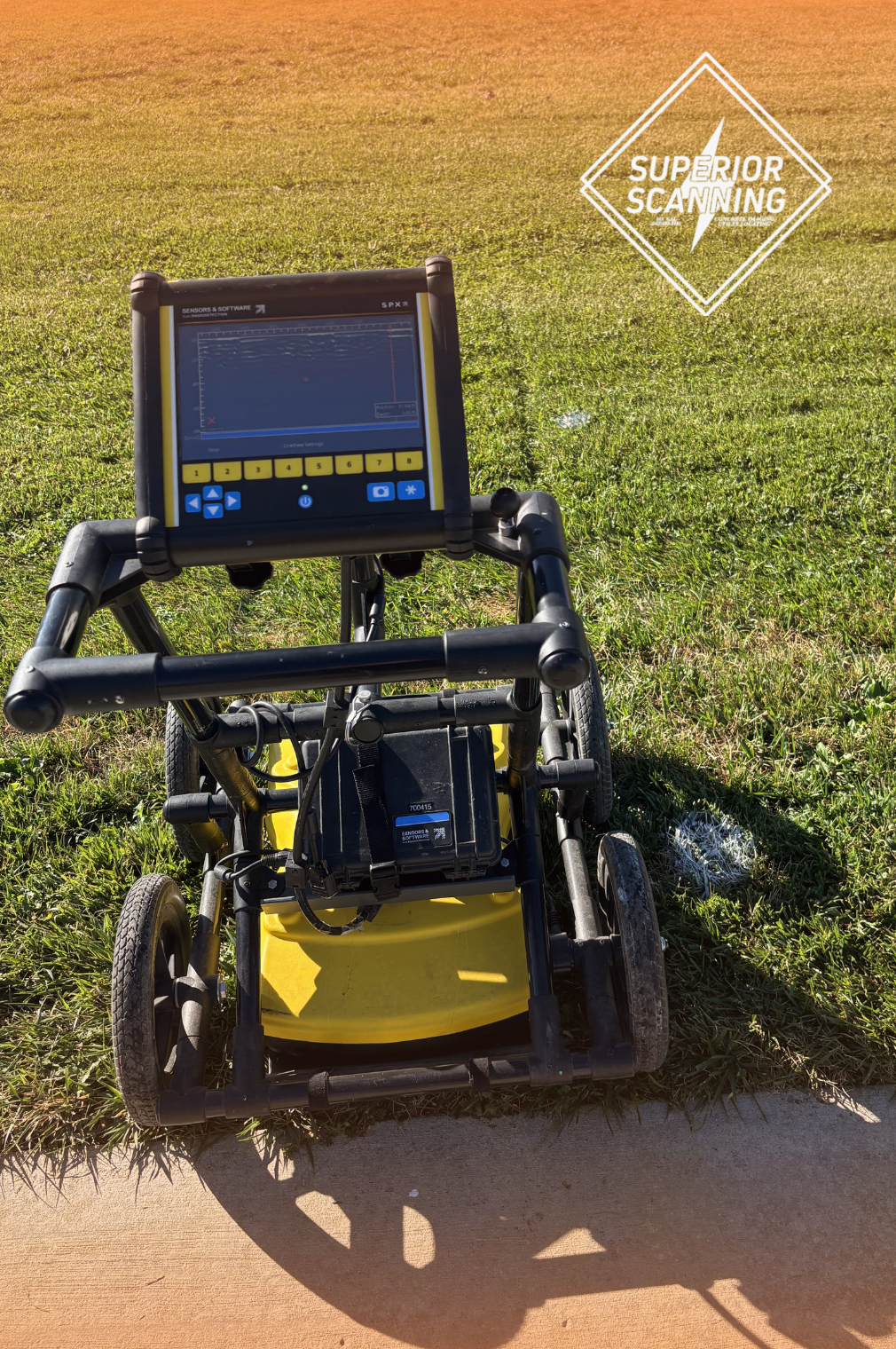
What Underground Utility Locator Equipment Does Superior Scanning Use?
Superior Scanning relies on a range of advanced tools to accurately detect and map underground hazards. Each device is chosen for its ability to handle specific site conditions and materials, ensuring safe and efficient project execution:Proceq GP8000
A compact Stepped-Frequency Continuous-Wave (SFCW) GPR system. It pairs with an iPad for real-time 2D/3D imaging, making it ideal for locating rebar, post-tension cables, and conduits in tight concrete spaces before cutting or drilling.Vivax-Metrotech vLoc3-RTK-Pro
An electromagnetic (EM) utility locator with built-in RTK GPS. It traces metallic lines and active cables while simultaneously logging centimeter-level coordinates to instantly generate highly accurate digital maps.ImpulseRadar PinPointR
A dual-channel GPR cart designed for sweeping soil and pavement. It detects both shallow and deep targets in a single pass, making it essential for locating non-metallic objects like PVC pipes, abandoned lines, and hidden voids. By matching the right equipment to the task, Superior Scanning keeps crews safe, prevents costly mistakes, and ensures projects stay on schedule.Don’t Cut, Core, or Drill Blind
Superior Scanning is trusted on complex job sites
Why Does Superior Scanning Use Different Tools?
Relying on just one piece of equipment is a rookie mistake on a messy, complex jobsite. Concrete scanning, general locating, and deep topographical mapping each require a very specific technological approach. Hunting down a plastic water line buried in wet clay takes a completely different method than trying to find a steel cable locked inside a concrete parking deck. Matching the proper scanner to the specific hazard drastically improves daily safety, structural accuracy, and long-term project planning. We lean on a diverse toolset simply because it guarantees reliable results no matter what surprises lurk below the surface.
When Should You Call A Professional Like Superior Scanning?
Bringing in a professional team ensures safety, accuracy, and efficiency whenever underground conditions are uncertain. Here are the key moments to make the call:- Before cutting, coring, or drilling concrete: Verify the slab is clear of hidden hazards to prevent dangerous strikes.
- Before excavation near suspected utilities: Confirm the exact depth and path of water, gas, or electrical lines to avoid costly accidents.
- When utility mapping is needed for planning: Detailed maps provide engineers with reliable data for redesigning trench routes.
- When better field decisions are required: Concrete scan results remove guesswork, helping crews work faster and safer.
Don’t Cut, Core, or Drill Blind
Superior Scanning is trusted on complex job sites
