Utility Mapping Services for Clearer Planning and Coordination
Field paint fades. Flags get moved. Site records can be outdated, incomplete, or hard to trust. On active commercial and construction sites, relying only on temporary surface markings can create confusion when excavation, trenching, utility tie-ins, layout changes, or future site work begins.
Superior Scanning provides utility mapping services in Southern California to help contractors, engineers, property teams, and facility managers organize utility information into a clearer project reference. Our work helps teams understand buried conditions before work starts, coordinate with fewer surprises, and keep site decisions grounded in real field information.
What Is Utility Mapping?
Utility mapping is the process of identifying, organizing, and documenting utility information so project teams can use it for planning, coordination, and construction decisions. It turns field findings into practical records that can support more than a one-time locate.
Instead of relying only on paint, flags, or old drawings, utility mapping gives multiple stakeholders a shared reference for what may be below the surface. This can be useful before excavation, trenching, site upgrades, design changes, facility improvements, and construction handoffs.
For projects focused mainly on buried utilities, see our underground utility mapping service.
When Utility Mapping Is Needed
You need mapping services before making any major changes to a site. Having solid documentation is critical when multiple stakeholders must share the exact same utility information. Project managers request these records to guarantee safe planning:
- Before excavation
- Before trenching
- Before design or layout changes
- When multiple stakeholders need shared utility information
- When documentation is required for planning or handoff
How Utility Mapping Works
Utility mapping combines physical field locating with organized data collection, verifying actual buried conditions against plans and delivering both field-ready markings and office-ready reports for seamless coordination.
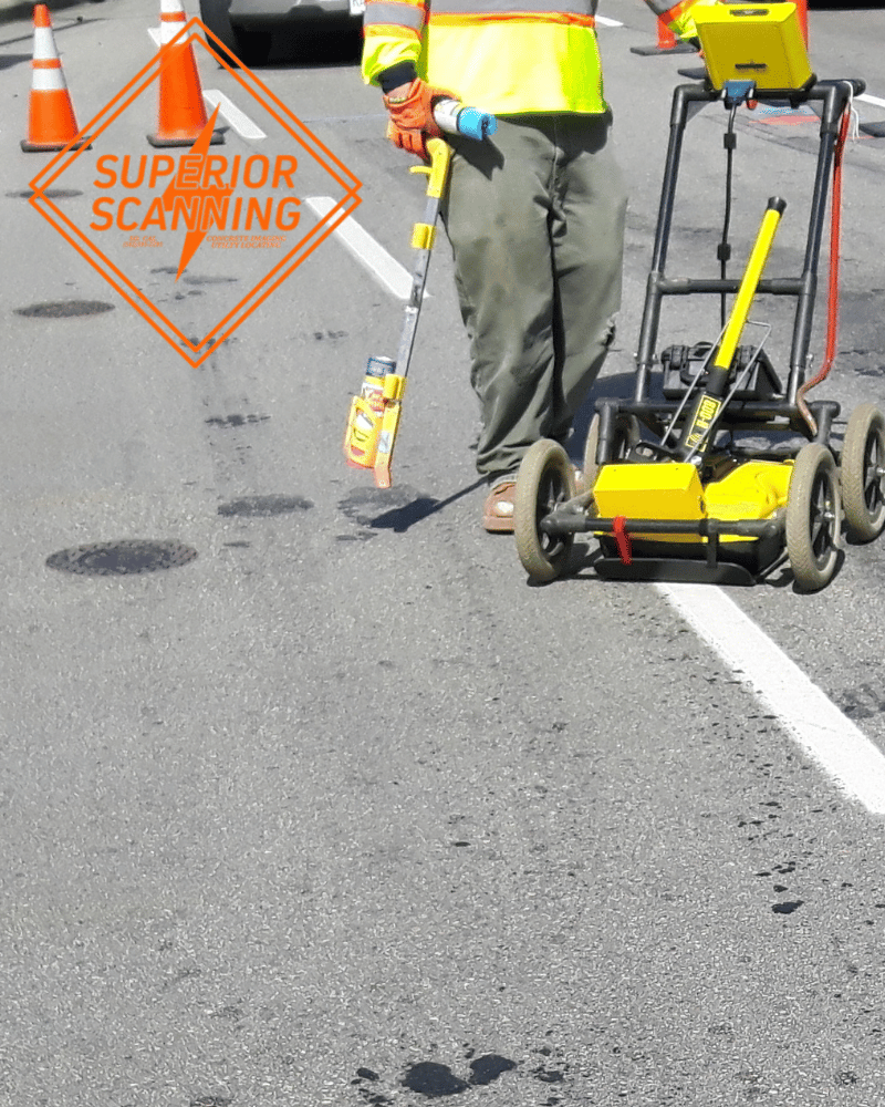
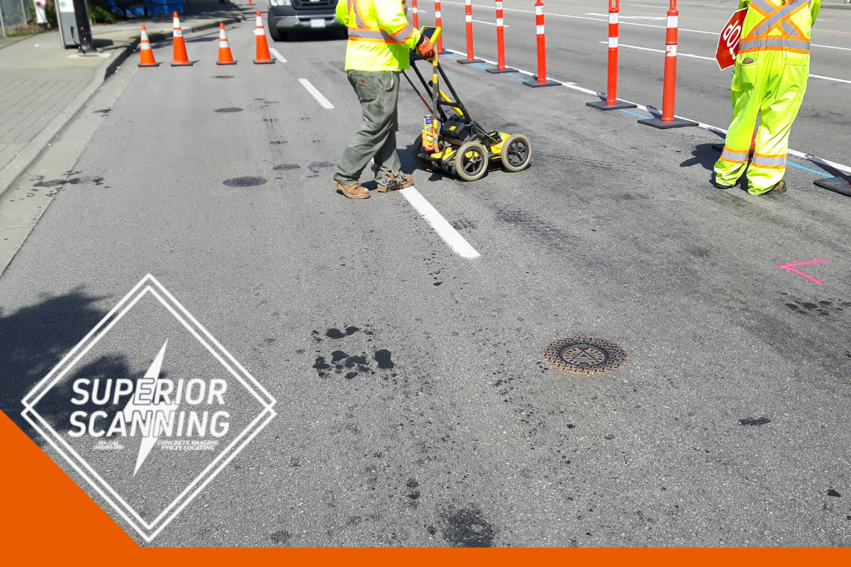
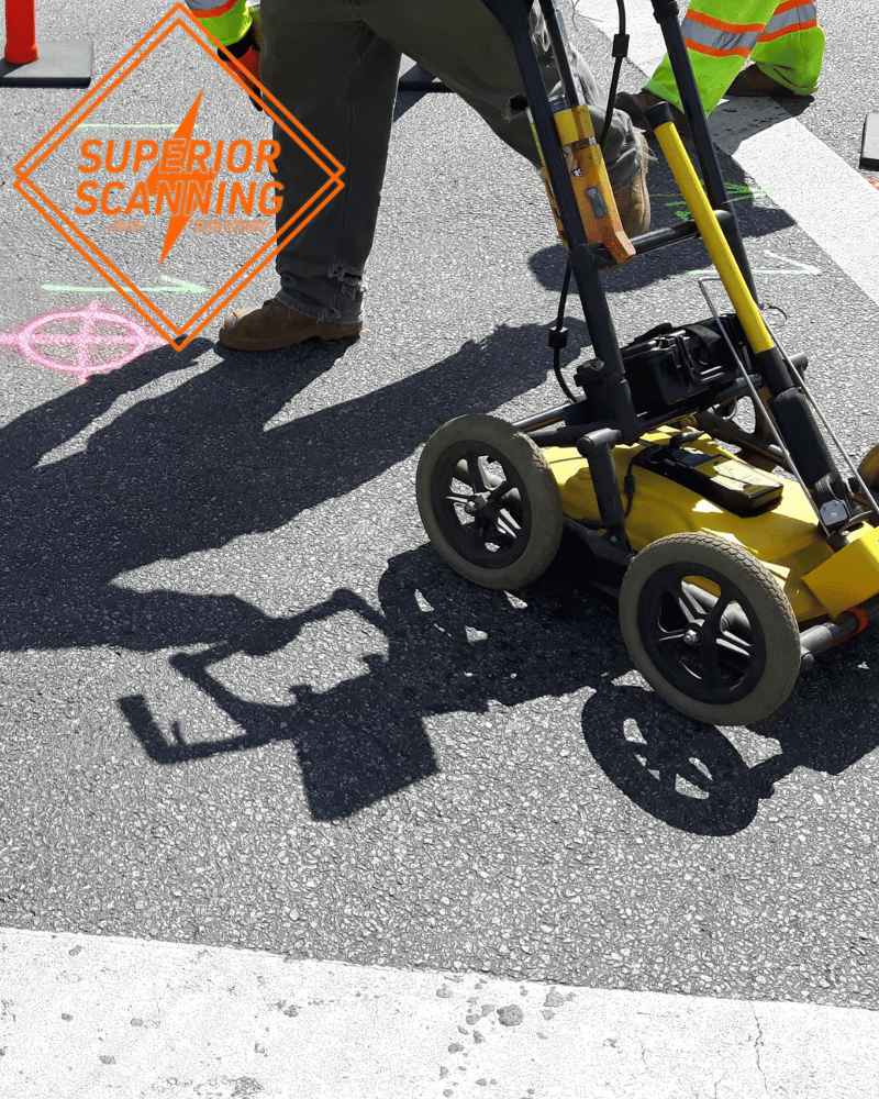
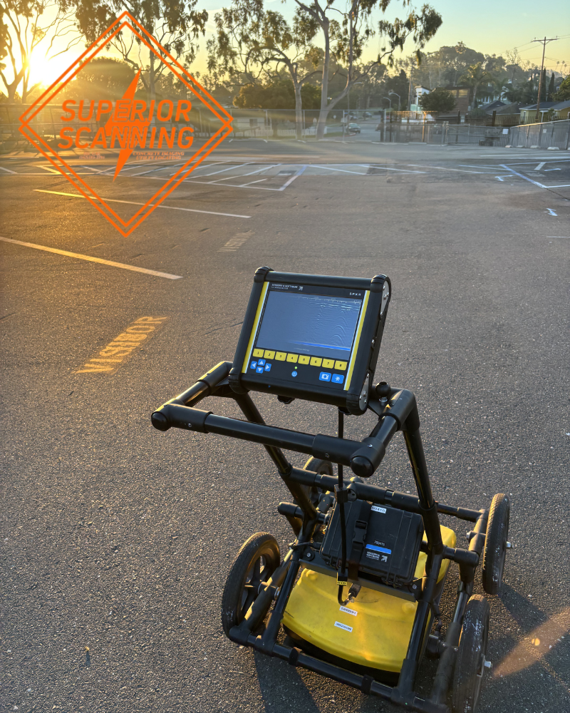
Field Collection and Utility Locating
Everything begins with boots on the ground. A trained technician physically identifies the buried lines on the job site. We then reference these findings to permanent landmarks around the property. Locating the lines is always the first step before we generate any mapped outputs.
Turning Field Data Into Usable Deliverables
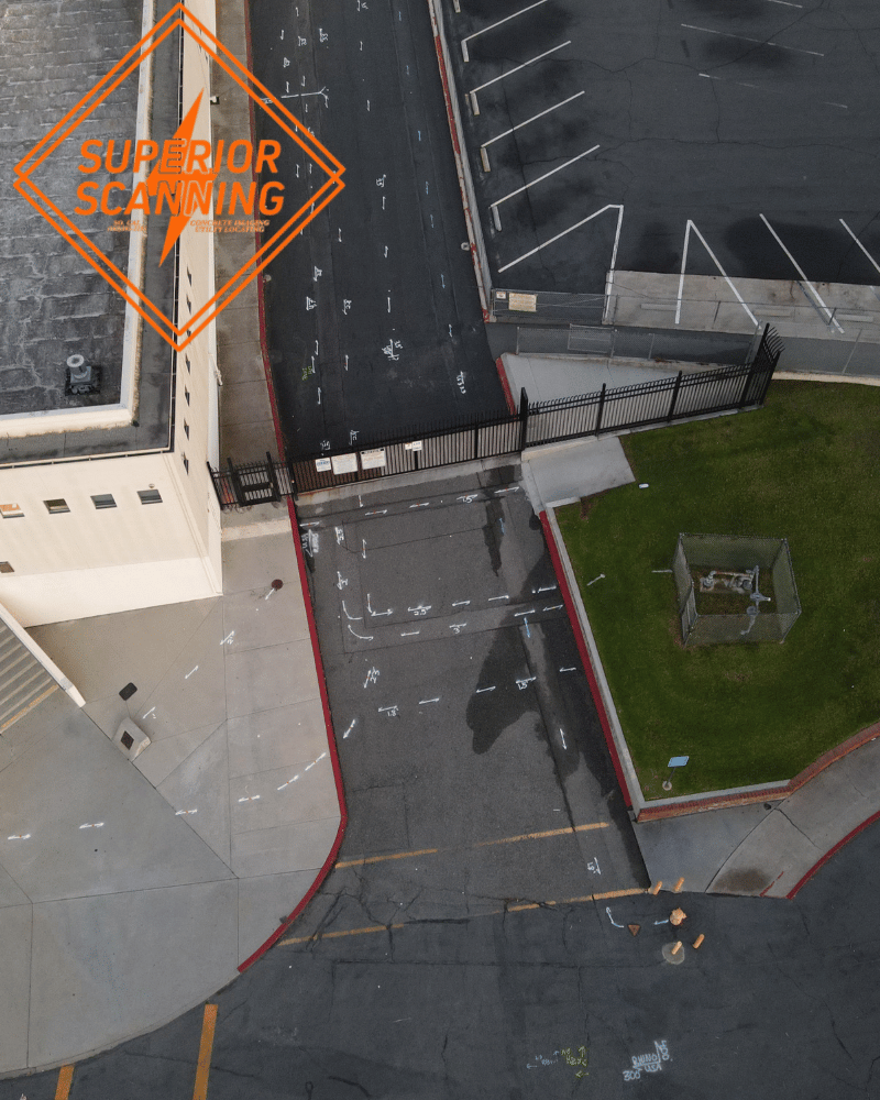
Raw data is useless if the team cannot read it. We take field findings and convert them into formats that make sense for the workflow. This means compiling detailed field notes and comprehensive photo documentation of the marked areas. We also build out formal mapped outputs when required, giving planners the exact records they need.
What Utility Mapping Can Include
A comprehensive mapping project delivers exactly what buyers need to keep work moving safely. We align deliverables with specific project demands to protect crews and budgets.
Underground Utility Mapping
Keeping track of buried lines is essential for major development. Underground utility mapping documents these hidden systems specifically for long-term planning purposes. This service is a lifesaver for active construction sites, college campuses, and complex infrastructure projects. Teams rely heavily on accurate subsurface utility mapping to avoid dangerous strikes during deep excavations.
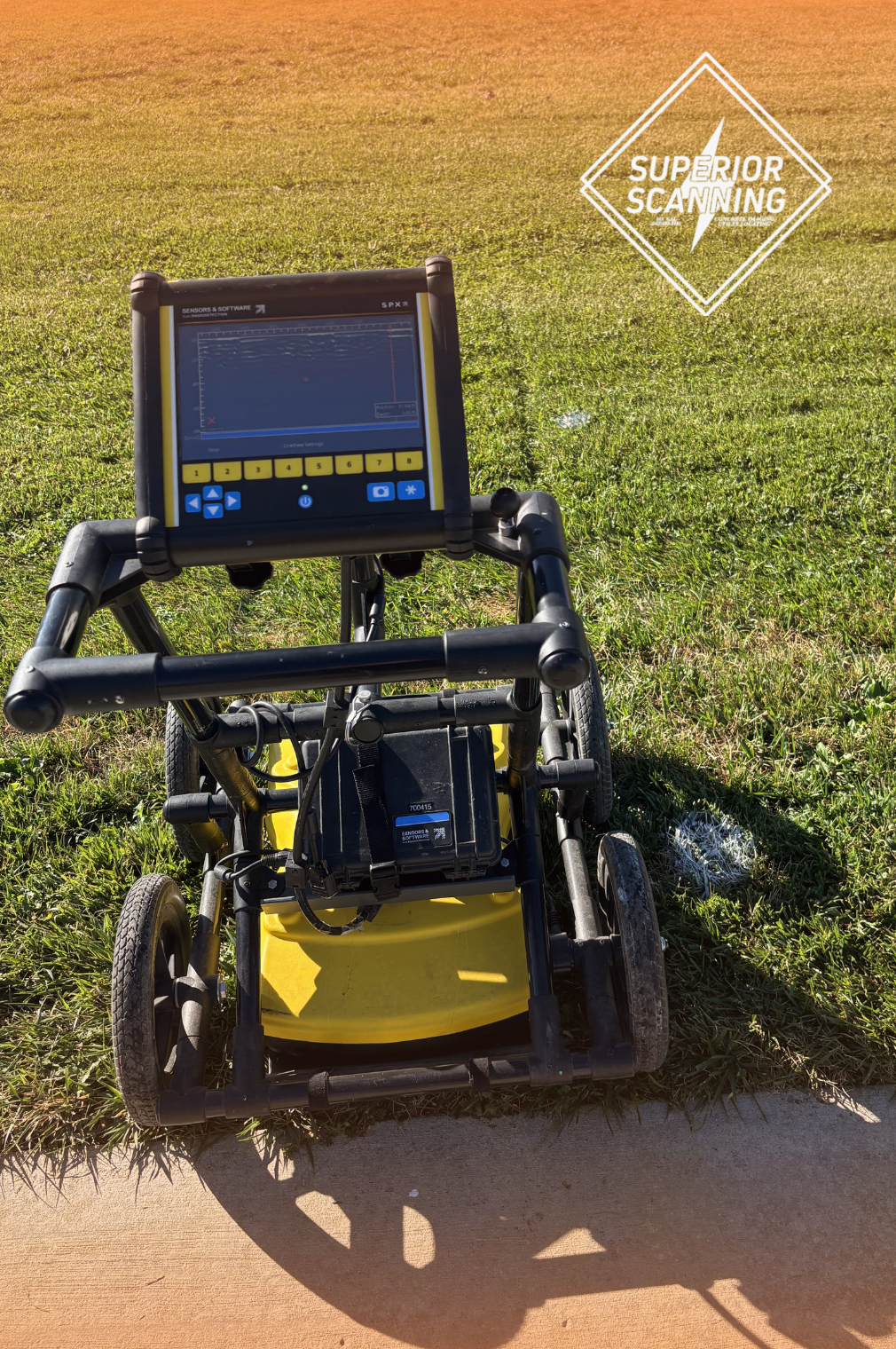
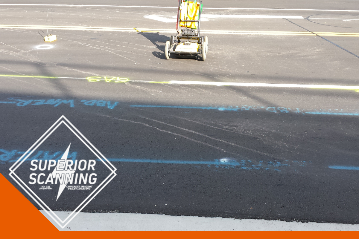
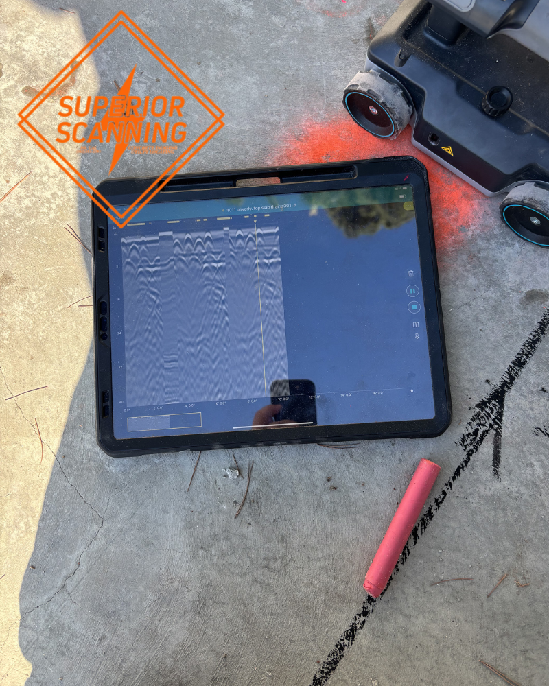
GPR Utility Mapping
Sometimes traditional tools miss non-metallic pipes. GPR utility mapping uses advanced radar technology as part of the overall documentation process. Technicians rely on ground penetrating radar for utility mapping to provide the engineering team with a much clearer picture of the subsurface environment.
Site Reference and Documentation
We tie physical field markouts directly to known, permanent locations on the property. The team provides clear notes and detailed photo documentation to help crews coordinate daily tasks without second-guessing the layout. We also offer scope-dependent digital outputs using underground utility mapping software when engineers require highly technical files. Some complex workflows even require specific utility mapping software to finalize civil engineering designs.
Utility Mapping vs Utility Locating
It is easy to confuse mapping with locating. Understanding the difference helps you request the exact right service for the job.
Utility Locating Finds Utilities in the Field
Utility locating is the physical act of tracking down hidden lines on the job site. Crews use this immediate service to make quick excavation or safety decisions right before they dig. It is a highly action-oriented process designed for teams ready to break ground today.
Utility Mapping Organizes Utility Information for Ongoing Use
Mapping takes those initial field findings and organizes them into reliable documentation. This organized approach supports long-term planning, multi-trade coordination, and future site work. It is extremely useful when several different teams need to share the exact same utility information over many months.
When Utility Mapping Adds the Most Value
Having a map provides the most value when coordinating a complicated site. Real-world situations show exactly how having organized documentation prevents massive headaches down the road.
For Construction Planning
Solid construction planning requires accurate data before anyone alters the layout. A detailed map is incredibly useful when several trades need to share the same utility information. It heavily supports preconstruction planning and keeps initial designs grounded in reality.
For Engineering and Transportation Projects
Civil engineering and transportation projects often operate under strict quality level expectations. Superior Scanning supports these specific workflows by delivering highly accurate field confirmation.
For Facility and Site Documentation
Good facility documentation provides a permanent record for industrial sites and large commercial properties. It is incredibly valuable when management teams need organized utility records for future modifications. Having this data on hand makes long-term planning significantly safer and faster.
Common Utility Mapping Deliverables
Common deliverables give the team the practical tools they need to interpret the site safely. Buyers understand exactly what they receive after the technicians finish the job.
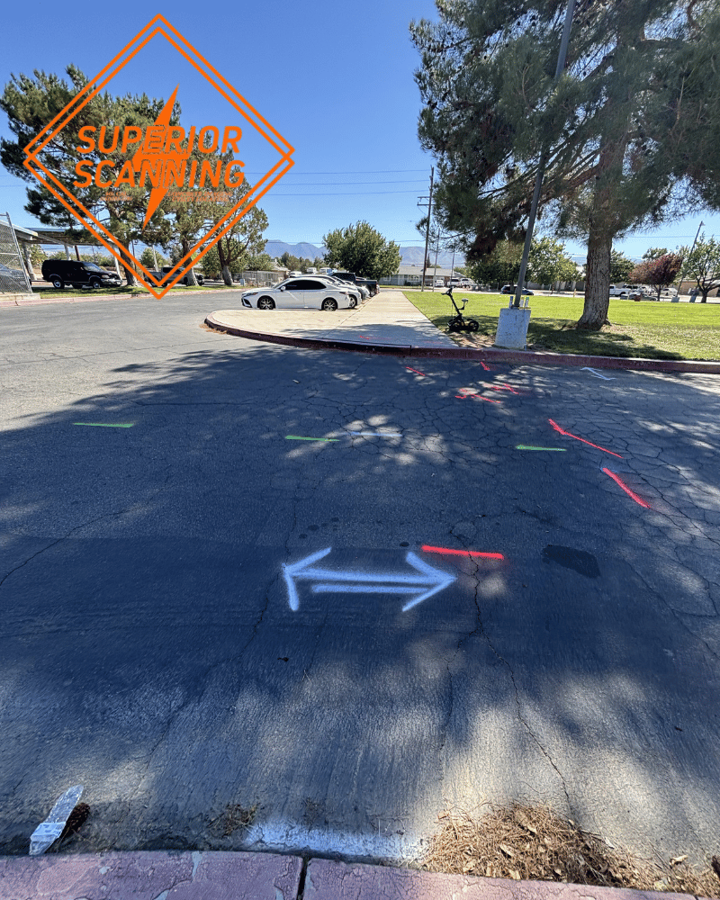
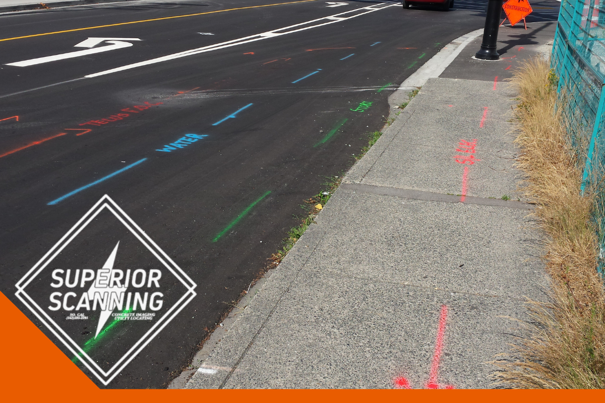
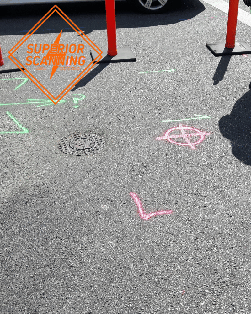
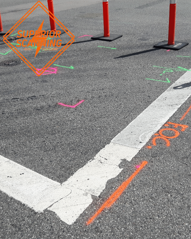
Field Markouts Tied to Site References
Common deliverables give the team the practical tools they need to interpret the site safely. Buyers understand exactly what they receive after the technicians finish the job.
Notes and Photo Documentation
Paint eventually washes away. Notes and photo documentation preserve the field results indefinitely. This documentation heavily supports coordination meetings, project handoffs, and future planning stages. It is highly useful when multiple stakeholders need to review the site without having to drive out there.
Digital Mapping Outputs When Required
We provide electronic records depending strictly on the specific project scope and needs. Our team tailors these digital deliverables to match what engineers and planners actually require. We focus on giving you usable data without forcing unnecessary formats on the team.
Who Uses Utility Mapping Services
These services are for anyone responsible for the safe and efficient management of a physical property.
Contractors and Construction Teams
General contractors, civil builders, and excavation teams use these maps to dig safely. Utility contractors also rely on these documents to install new lines without accidentally hitting existing ones. These records give fast-moving field crews a shared reference point they can trust implicitly.
Engineers, Facility Teams, and Property Stakeholders
Civil engineers and project managers use mapping data to design better, safer sites. Property owners request these records to understand exactly what they own underground. Both public and private project teams depend on this critical information to avoid catastrophic utility strikes.
Why Choose Superior Scanning for Utility Mapping
Superior Scanning provides the exact documentation needed to run a safe and organized project. We help you feel completely confident before ground breaks
Jobsite-Ready Utility Information
We deliver clear and highly practical deliverables directly to the team. You get usable information designed specifically for seamless planning and coordination. We place a strong emphasis on clarity rather than confusing the project with heavy technical jargon.
Support for Active Commercial Sites
Our technicians excel at providing support for fast-paced and highly active commercial jobsites. We understand the daily complexities of multi-trade coordination and work quietly around active crews. You can always expect responsive service and clear communication.
Alignment With Project Workflow Needs
We ensure complete alignment with workflow needs by tailoring field collection to the exact scope. Our team easily supports strict documentation expectations for complex engineering projects. We possess a deep understanding of daily planning and coordination requirements.
Utility Mapping Service Areas
Local coverage matters when schedules are tight and the site needs answers quickly. We travel directly to the jobsite fully equipped and ready to work.
Areas We Serve
Superior Scanning provides utility mapping services across Southern California, including:
- Los Angeles
- Orange County
- Riverside
- San Diego
- Surrounding Southern California areas
Looking for Utility Mapping Near Your Project Site?
If you are searching for utility mapping near your project site, Superior Scanning serves projects across Southern California. Call or request a quote to schedule service for your site.
Frequently Asked Questions
What is utility mapping?
Utility mapping is the process of locating underground lines and organizing that information into usable documentation for project planning.
What is the difference between utility mapping and utility locating?
Locating identifies utilities directly in the field, while mapping organizes those field results for long-term planning and documentation.
What types of projects need utility mapping?
Construction planning, engineering coordination, facility documentation, and multi-trade project work all require accurate mapping services.
Can GPR be used for utility mapping?
Yes, we use Ground Penetrating Radar to map non-metallic utilities and provide a comprehensive view of the subsurface.
What deliverables are included?
Our deliverables typically include field references, detailed notes, photo documentation, and digital outputs if scoped in the project.
Do you provide utility mapping in Southern California?
We provide mapping services throughout Southern California and encourage you to contact us to schedule a site visit.
Request Utility Mapping Services
Securing accurate utility records is the smartest move you can make before breaking ground. Call now or request a quote to get experienced technicians on the site quickly. Describe the site to the team, explain the project scope, and ask about timing and specific deliverables. Taking action today gives the team the reliable utility mapping data needed to work safely and avoid massive delays.
Related Services: Concrete Scanning, Private Utility Locating, Rebar Scanning Services, Post-Tension Cable Scanning, and Conduit Scanning in Concrete.