
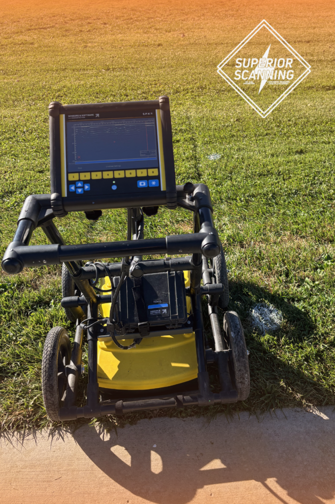

Trenching blindly into a commercial concrete slab, hoping to miss hidden plastic pipes, creates a fast track to disastrous flooding, electrical hazards, and massive project shutdowns. While standard locating tools excel at finding metal, modern construction relies heavily on plastics that remain completely invisible to traditional magnetic sweeps.
Partnering with the experienced technicians at Superior Scanning ensures precise subsurface data before breaking ground, eliminating the dangerous guesswork of commercial excavation. Utilizing an advanced ground-penetrating radar (GPR) scanner protects the site, keeps the crew safe, and guarantees the development stays strictly on schedule.
Table of Contents
Don’t Cut, Core, or Drill Blind
Superior Scanning is trusted on complex job sites
Why Do Traditional Locators Fail on Plastic?
Conventional locating tools rely on electromagnetic fields to trace buried infrastructure. This approach has severe limitations when applied to modern plumbing materials. Because these tools need a continuous metallic line to carry a signal, plastic pipes simply do not register.
Electromagnetic Signal Limitations
Standard locators send a frequency down a metal pipe or wire to create a traceable path. Plastic materials cannot carry this frequency. The signal drops off immediately upon hitting a non-conductive surface, leaving the operator blind to what lies beneath.
Lack of Conductive Material
Modern utilities favor polyvinyl chloride (PVC) for durability and cost savings. Since PVC contains no metallic elements, magnetic locators pass right over it without making a sound. Crews need specialized ground-penetrating radar equipment to actually see these invisible hazards.
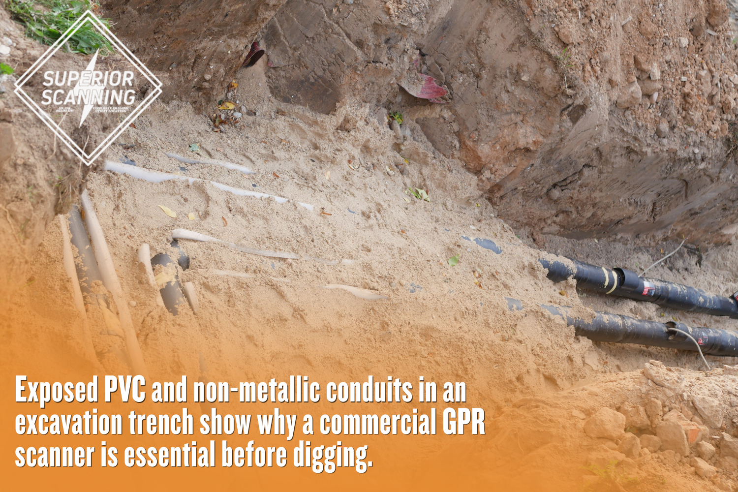
How Does Subsurface Radar Technology Find PVC?
Ground penetrating radar (GPR) operates completely differently from traditional metal detectors. Understanding exactly how GPR works reveals why an advanced GPR machine excels at pinpointing plastic materials hidden deep underground. The technology relies on a precise sequence of actions to map the environment.
Emitting High-Frequency Radio Waves
The radar unit pushes electromagnetic pulses directly into the soil or concrete. These waves travel downward until hitting a change in the subsurface material. The machine records the exact time it takes for those waves to bounce back to the surface.
Detecting Dielectric Contrasts
Every buried material has a specific density and electrical property. The radar highlights the difference between the dense surrounding soil and the hollow air or water inside a plastic pipe. This contrast forces the radio waves to reflect differently.
Creating Real-Time Subsurface Imagery
Returning signals are displayed as a graph on the unit’s screen. Trained technicians interpret these hyperbolic shapes to determine the exact location of the buried pipe. A proper GPR scan turns these abstract waves into clear, actionable site maps.
What Factors Affect Radar Detection Success?
Several environmental and physical variables determine the clarity of a radar survey, making it critical for technicians to account for these specific conditions before starting the mapping process:
- High clay content in the surrounding soil
- Excessive moisture or standing water
- The physical size of the target conduit
- Overall ground penetrating radar depth limits
Don’t Cut, Core, or Drill Blind
Superior Scanning is trusted on complex job sites
Why Choose Commercial Radar Equipment?
Consumer-grade gadgets lack the processing power required for complex commercial construction sites. Using professional ground-penetrating radar equipment ensures highly accurate GPR utility mapping data for safe excavation. Advanced systems handle rough terrain and deep targets far better than basic hobby models.
Superior Signal Penetration
Professional units use specialized antennas to push signals deeper into tough materials like reinforced concrete. The increased power cuts through dense layers that block weaker signals. This strength is crucial for safely reaching the maximum ground-penetrating radar depth.
Multi-Frequency Data Collection
Commercial scanners operate on multiple frequencies simultaneously to capture a complete picture. High frequencies find shallow objects with great detail, while low frequencies reach much deeper into the earth. Combining both data sets produces a comprehensive view of the subsurface.
Accurate Utility Mapping Deliverables
A professional survey provides more than just a quick glance at a screen. Technicians process the GPR scanning data to create permanent digital records and site markouts. These precise deliverables provide project managers with a reliable map of all hidden plastic and metal conduits.
When Should Project Managers Schedule a Scan?
Timing a utility survey correctly prevents costly accidents and keeps the job site safe, making it necessary to request professional subsurface imaging during these specific phases:
- Prior to core drilling or saw cutting concrete slabs
- During the initial pre-construction planning phase
- Immediately after discovering undocumented utilities
- Before trenching for new commercial plumbing lines
Don’t Cut, Core, or Drill Blind
Superior Scanning is trusted on complex job sites
Frequently Asked Questions
Can a GPR scanner find empty PVC pipes?
Yes, the radar detects the density difference between the surrounding soil and the air inside the empty plastic pipe, making it visible on the scan.
How deep can a commercial GPR scanner penetrate?
Depending on the soil composition and material density, commercial units can accurately detect objects up to 15 feet beneath the surface.
Does water inside a plastic pipe affect the scan?
Water actually improves detection visibility because it creates a stronger dielectric contrast against the surrounding dry soil or concrete.
What is the difference between an electromagnetic locator and a GPR scanner?
Electromagnetic locators require a conductive metallic material to trace a signal, whereas ground penetrating radar detects changes in material density, allowing it to find non-metallic objects.
How long does a standard commercial GPR scan take?
A standard survey typically takes a few hours, though the exact timeline depends entirely on the size of the scanning area and the complexity of the buried infrastructure.
Will Hidden Conduits Derail the Next Excavation?
Striking an unmarked PVC water main brings operations to a complete standstill and introduces massive financial liability. Securing professional gpr scanning eliminates the guesswork and keeps commercial developments strictly on schedule.
At Superior Scanning, highly trained technicians serve active construction and facility sites across Southern California, including Los Angeles County, Orange County, Riverside County, and San Diego County. Request a competitive, flat-rate, or hourly quote today to ensure a completely safe excavation phase.
