
Don’t Cut, Core, or Drill Blind
SuperiorGPR is trusted on complex job sites
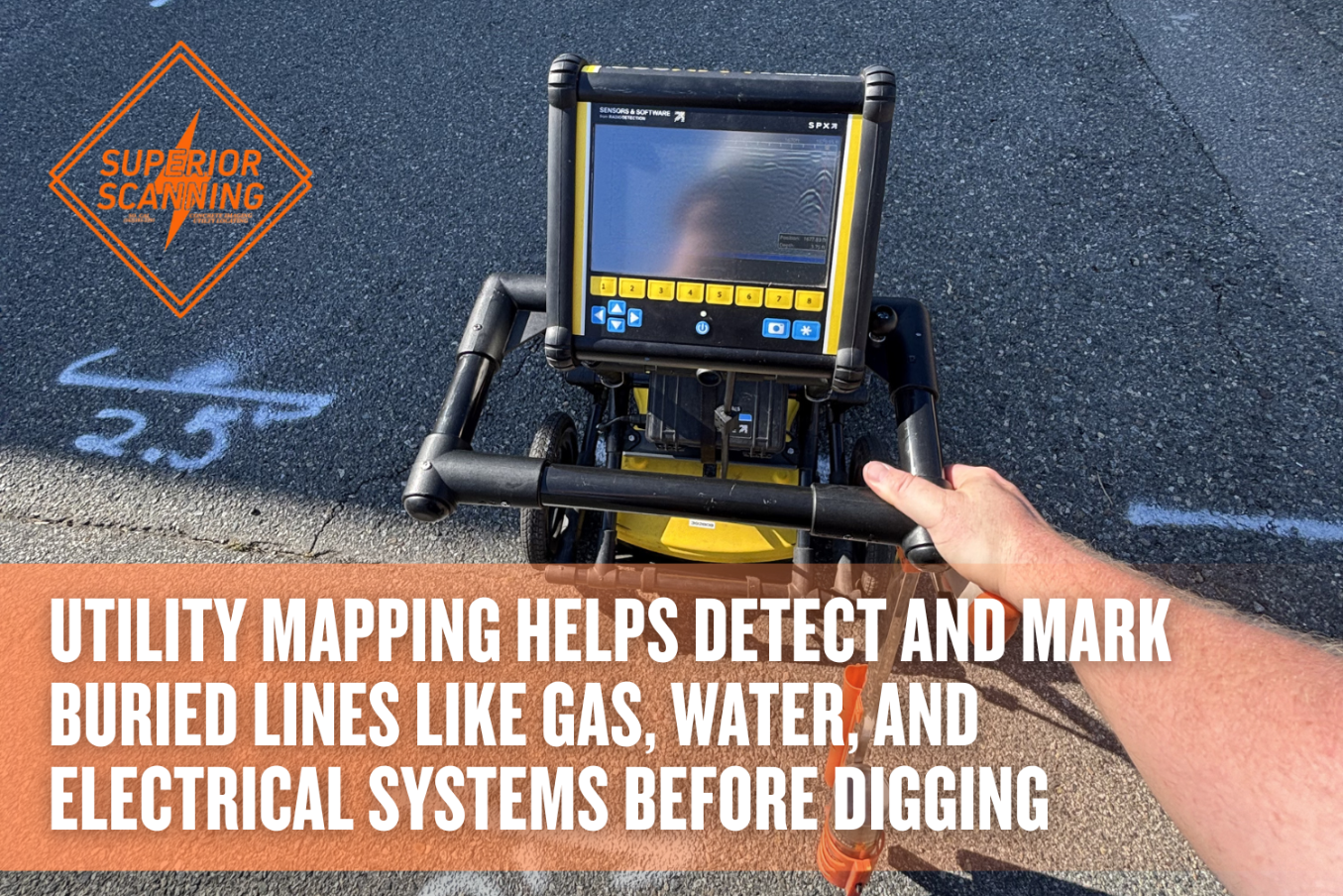
Quick Review on Utility Mapping Services
- Helps identify buried underground utilities before excavation begins
- Supports safer planning for digging, trenching, and site work
- Can reduce the risk of utility strikes, repair costs, and project delays
- Adds visibility when public markings do not cover all private lines
- Gives crews better information for layout, line marking, and excavation decisions
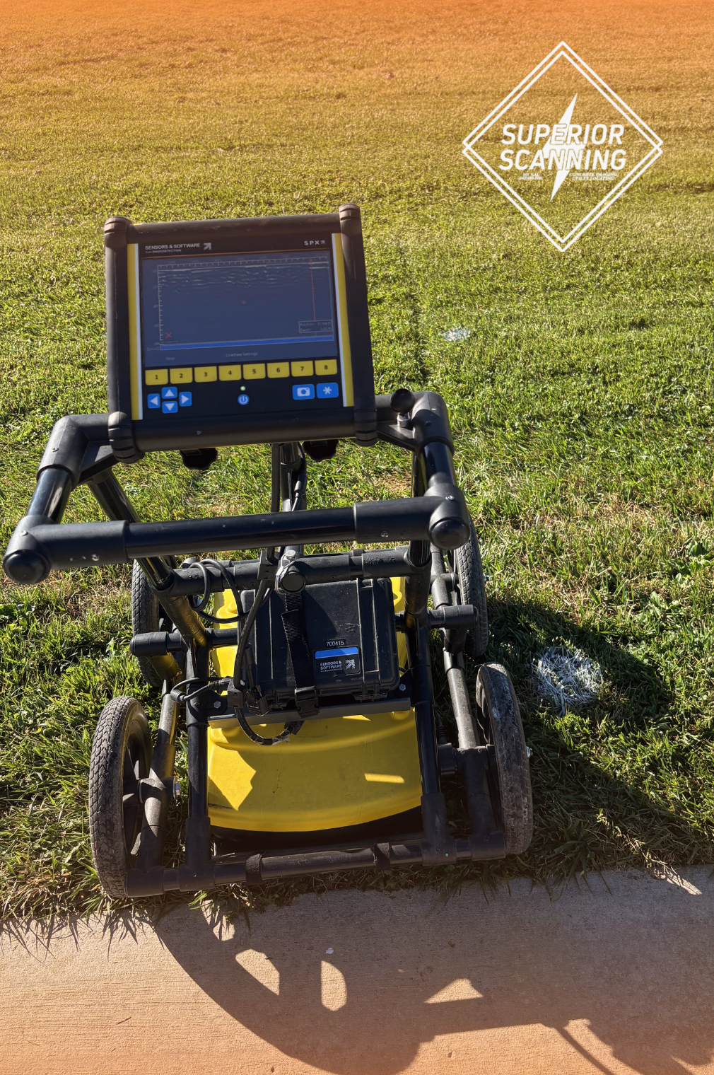
What Is Utility Mapping?
Utility mapping is the process of identifying and documenting known or detected underground utilities in a planned work area. Depending on the scope and method used, the deliverable may include field markings, sketches, digital maps, or survey-based plans showing utility paths and, where available, estimated depth information.
This process helps crews plan excavations with better information, rather than relying solely on records or assumptions. Surface locating methods can often identify the approximate path of buried utilities, while precise horizontal and vertical position may require test holes or other forms of direct verification when the project demands a higher level of certainty.
The Difference Between Public and Private Utility Locating Services
The difference between public and private utility locating services is easier to understand when broken into a side-by-side comparison:
| Category | Public Utility Locating Services | Private Utility Locating Services |
|---|---|---|
| Primary purpose | Marks participating public utilities before excavation | Helps identify utilities that may fall outside the scope of public marking |
| How it is requested | Typically requested through 811 before digging | Typically arranged directly through a private locating company |
| Coverage | Covers participating buried utilities based on state rules and facility ownership | Covers private-side or site-specific utilities that may not be included in a public locate |
| Accuracy | Marks the approximate location of participating buried utilities | Helps provide additional subsurface information based on the methods used and site conditions |
| Common examples | Public electric, gas, water, sewer, or telecom lines within the participating system | Private electric lines to detached structures, irrigation, site lighting, private gas, septic-related components, or communications lines |
| Limitations | Does not provide a complete map of every underground line on a property, and coverage can vary by state and ownership | Scope, deliverables, and level of detail can vary depending on the provider and project needs |
| Best use case | First step before excavation in the U.S. | Added support when a site may contain private or unmarked underground utilities |
Don’t Cut, Core, or Drill Blind
SuperiorGPR is trusted on complex job sites
How Expert Utility Locators Find Hidden Lines
Utility locators often combine multiple nondestructive methods to investigate buried utilities before excavation. These methods can help identify likely utility paths and reduce uncertainty in the planned work area without starting with open-cut digging.
Field crews may use ground-penetrating radar and electromagnetic locating together, depending on the utility type and site conditions. Ground-penetrating radar (GPR) uses non-ionizing radio waves and can help detect many buried features, including some non-metallic utilities, but its performance can be limited by wet or clay-heavy soils.
Electromagnetic locating is commonly used to trace conductive utilities or lines carrying a passive, applied, or induced signal. After utilities are designated, crews commonly mark the surface using standard American Public Works Association (APWA) color codes and may provide mapped documentation for planning.
Why You Need Specialized Underground Utility Contractors
Specialized underground utility contractors bring trained personnel, field experience, and equipment that can improve the quality of subsurface information before excavation. On complex sites, that added detail can reduce the chance of utility conflicts, rework, and unplanned downtime.
Professional utility locating is especially useful when record drawings are incomplete, the site includes private utilities, or the excavation area is congested. A qualified provider can also help distinguish between record-based information, approximate field designations, and locations that still need direct verification before high-risk work begins.
What to Expect from Underground Utility Locating Services
Underground utility locating services typically include several key steps and deliverables:
- Reviewing the project scope, available records, and site conditions before fieldwork begins
- Investigating the planned work area using locating methods suited to the utility types and surface conditions on the site
- Marking detected utilities on the surface when included in the scope
- Documenting findings through notes, sketches, digital mapping, or reporting for project planning
- Confirming the expected quality level, reporting format, and field-marking scope before work begins, since final deliverables can vary
Don’t Cut, Core, or Drill Blind
SuperiorGPR is trusted on complex job sites
Frequently Asked Questions
How accurate is utility mapping?
Accuracy depends on the method used, the utility type, and site conditions. Surface geophysical methods are often used to determine the approximate horizontal position of buried utilities, whereas precise horizontal and vertical locations typically require direct exposure or verification at specific points.
How deep can locators scan?
Depth depends on the technology, target, and soil conditions. GPR performance is often reduced in wet or clay-heavy soils, while favorable conditions can allow deeper imaging. A site-specific assessment gives a more reliable expectation than a single depth estimate.
Do I need a line marking service for a residential project?
For residential digging in the U.S., contacting 811 before excavation is essential. A private utility locate may also be worth considering when the property includes irrigation, detached structures, private lighting, private gas lines, data lines, or other facilities that may fall outside public utility marking.
What happens if you hit an underground utility?
Striking an underground utility can cause injury, service interruptions, repair costs, project delays, and possible regulatory or liability issues, depending on the utility involved and the severity of the damage.
How long does utility locating take?
Utility locating time varies based on site size, utility density, access conditions, and the scope of documentation required. Small areas may be completed relatively quickly, while larger or more complex sites can take longer.
Secure Your Excavation Project With Expert Utility Mapping
A utility mapping plan can give a project team better visibility into buried infrastructure before excavation begins. That added information can support safer planning, reduce avoidable utility conflicts, and improve coordination in the field.
When a site may include both public and private utilities, professional locating can help close information gaps before digging starts. Contact Superior Scanning to discuss the project scope, site conditions, and the level of utility investigation that fits the work area.
