
A buried line can stop a job before the first major cut is made. Utility mapping gives design teams a clear view of pipes, cables, conduits, and other buried systems before plans move from paper to the field.
Striking an unknown line can cause shutdowns, repair costs, safety hazards, and design changes that should have been caught earlier. Superior Scanning helps project teams use underground utility mapping early, so site designs are safer, cleaner, and easier to build.
Table of Contents
Don’t Cut, Core, or Drill Blind
Superior Scanning is trusted on complex job sites
What Hidden Dangers Exist Underneath a Construction Site?
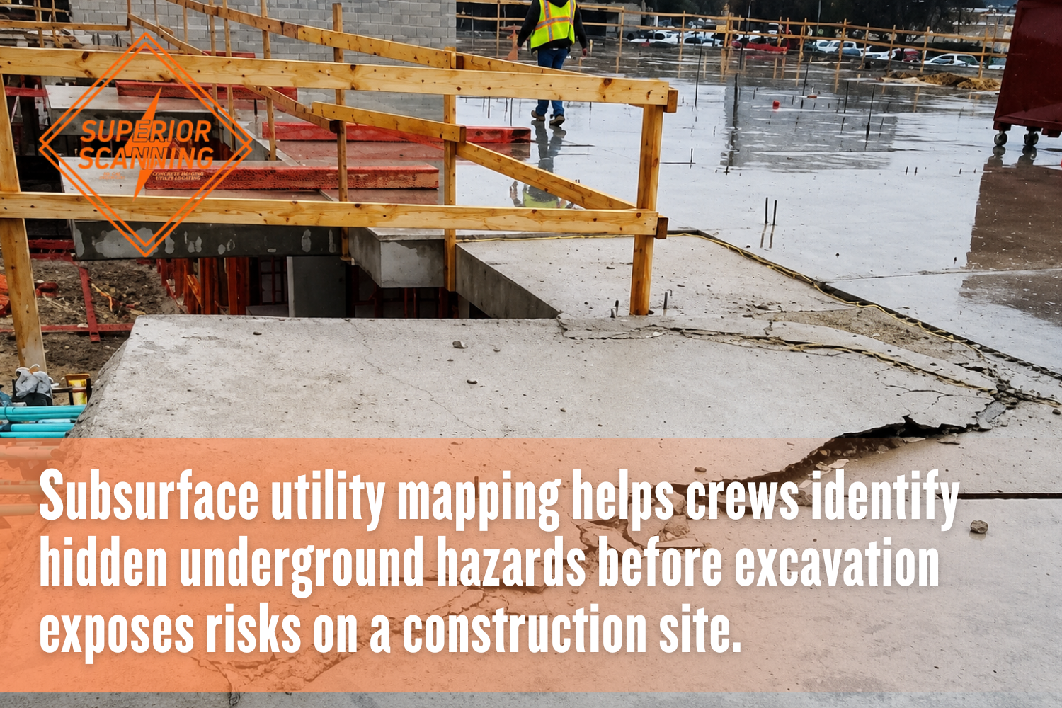
Hidden utilities can lie beneath parking lots, sidewalks, access roads, landscaped areas, and open lots that appear clear on the surface. Subsurface utility mapping helps crews find risks before excavation exposes them the hard way.
A thorough utility survey detects several critical underground hazards:
- High-voltage electrical lines that can injure workers and shut down nearby services
- Gas mains that create fire, explosion, and evacuation risks
- Pressurized water pipes that can flood trenches and damage nearby structures
- Sewer lines that may cause sanitation problems if broken
- Communication cables that can disrupt internet, phone, or security systems
- Irrigation lines that 811 may not mark on private property
- Unknown conduits left behind from older site work
- Drainage lines that affect grading, paving, and stormwater plans
These hazards are not always shown on old plans. Accurate utility locating gives designers better field data before layout, trenching, or equipment access decisions are locked in.
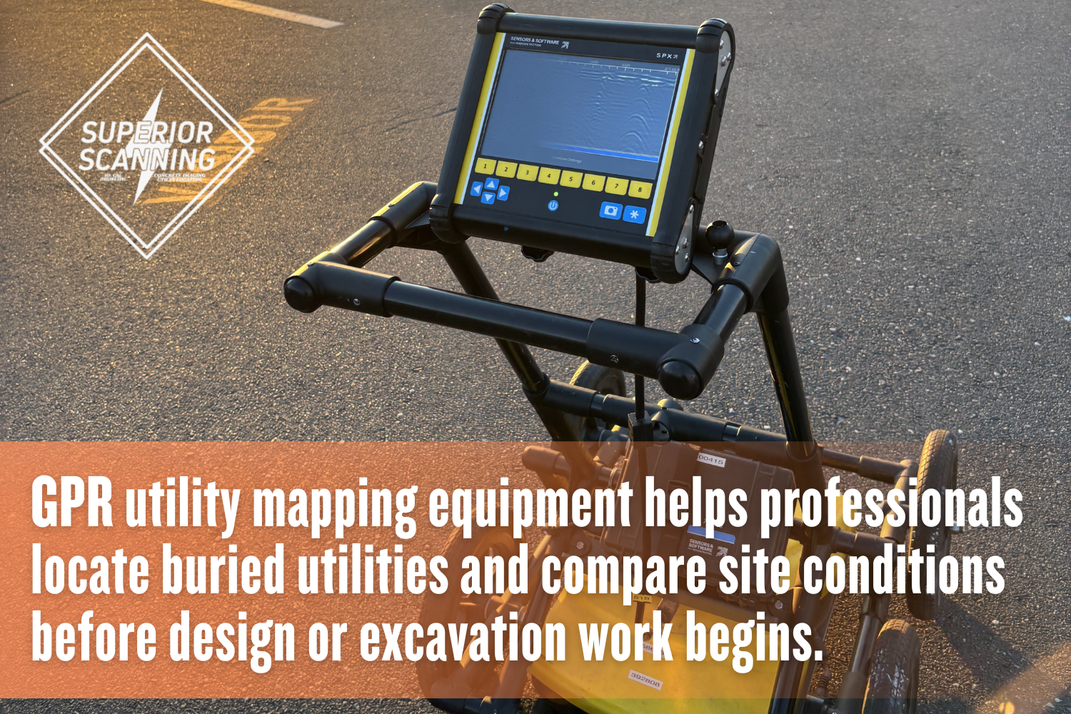
How Does GPR Utility Mapping Prevent Design Clashes?
Ground Penetrating Radar (GPR) utility mapping helps prevent design clashes by showing where buried objects may conflict with proposed work. The data allows engineers to move footings, trenches, poles, bollards, drains, and other site features before construction begins.
A network mapping utility view also helps project teams compare planned routes against existing underground paths. That early comparison can reduce change orders, avoid field surprises, and keep crews from redesigning under pressure.
Clash Detection Integration
Clash detection works best when field data is added before the final design is approved. GPR utility mapping can show utility paths that may cross planned excavation zones, foundation areas, or trench routes.
Designers can then review those findings with civil plans, site drawings, and utility layouts. When underground utility mapping is treated as part of design review, the team can adjust plans before crews reach the job site.
Blueprint Adjustment Protocols
Blueprint changes are easier and cheaper before construction starts. Once utility mapping services identify a likely conflict, the design team can shift routes, add clearance, change depths, or plan safer access points.
This step also gives field crews clearer direction. Instead of guessing around old records, the team works from updated drawings and surface markings based on real site conditions.
Don’t Cut, Core, or Drill Blind
Superior Scanning is trusted on complex job sites
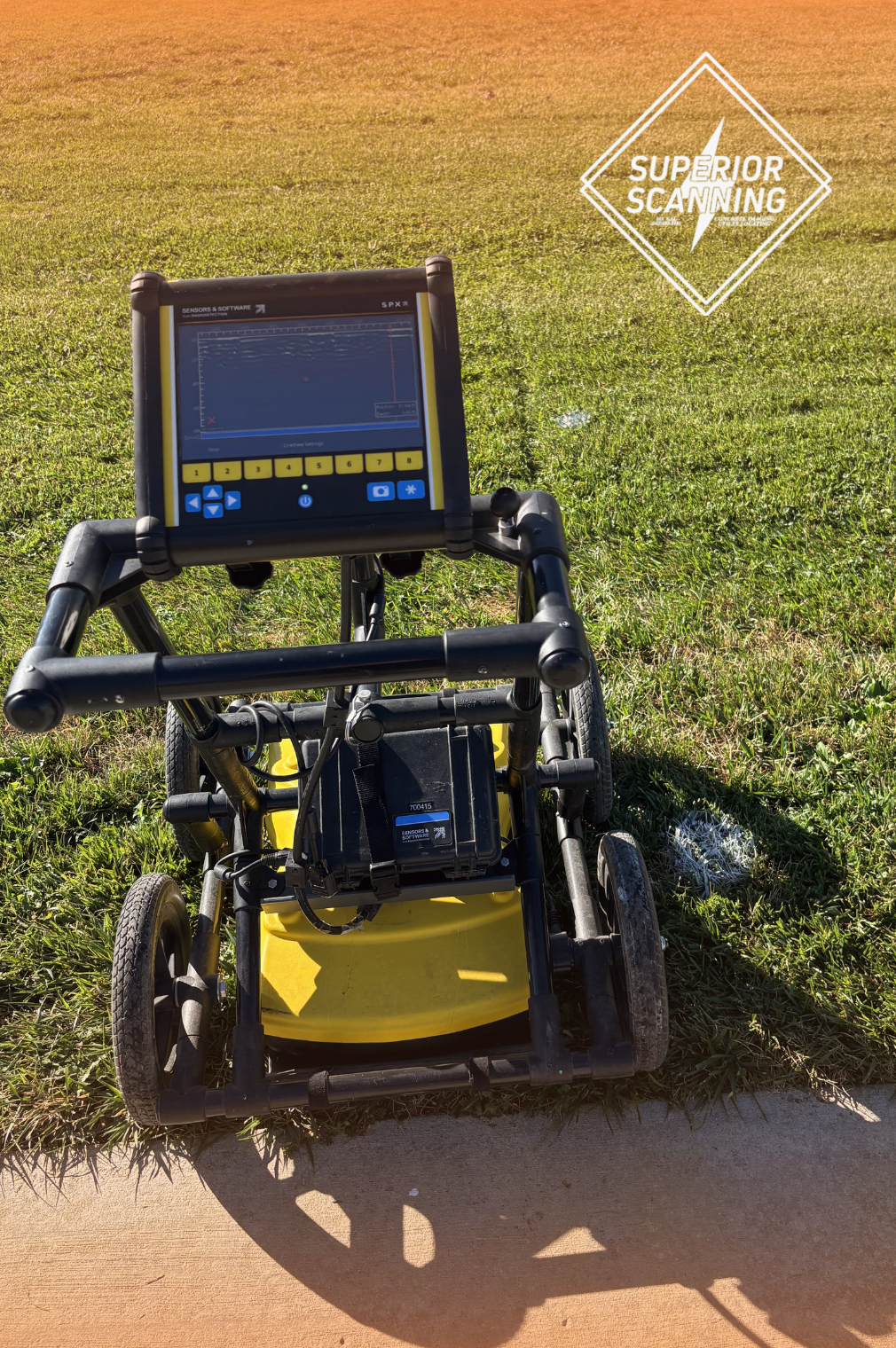
Which Underground Utility Locator Methods Work Best?
The best underground utility locator method depends on the site, soil, surface access, and type of buried line. No single tool finds every utility in every condition, so professionals often use more than one method for a cleaner read.
Professionals use a combination of specialized technologies to improve accuracy:
- Ground Penetrating Radar (GPR): Sends radar signals into the ground and reads reflections from buried objects, voids, and changes below the surface.
- Electromagnetic locators: Trace conductive lines, such as metal pipes or cables, when a signal can be applied or detected.
- Vacuum excavation: Uses air or water to safely expose utilities at key points, helping confirm location and depth.
- Site records review: Compares old plans, as-builts, and visible utility features with field findings.
- Surface markouts: Places paint, flags, or markings on the ground to help crews see the likely path of buried utilities.
Good utility locating is not just about finding a line. It is about combining evidence, assessing conditions, and providing the project team with information for design and field planning.
When Should You Schedule Utility Locating?
Utility locating should be scheduled before final site design, not after excavation is ready to begin. Early work with an underground utility locator gives the design team time to solve conflicts without rushed decisions.
Waiting until the last review can lead to plan changes, permit delays, or layout problems in the field. Early subsurface utility mapping helps the project stay organized from concept to construction.
Pre-Design Phase
The pre-design phase is the best time to start underground utility mapping. At this stage, the team can use field data to shape the site plan rather than forcing the design to accommodate surprises later.
This is especially useful for commercial properties, campuses, parking lots, industrial sites, and older buildings with incomplete records. A skilled underground utility locator can help identify risks before design choices become expensive to change.
Final Blueprint Review
The final blueprint review is the last chance to catch utility conflicts before work reaches the ground. Updated utility mapping services can help confirm that planned excavation areas, trench routes, and access points still make sense.
This review also helps contractors prepare safer work zones. When plans, markings, and field notes match, crews can work with more confidence and fewer stoppages.
Don’t Cut, Core, or Drill Blind
Superior Scanning is trusted on complex job sites
Frequently Asked Questions
What is underground utility mapping?
Underground utility mapping is the process of locating and documenting buried lines to enable design teams to plan safer excavation and construction work.
How deep can GPR utility mapping see?
GPR utility mapping depth depends on soil, moisture, surface conditions, and antenna type, so a professional scan is needed to judge what can be detected on a specific site.
Are utility mapping services highly accurate?
Utility mapping services can be highly accurate when professionals combine Ground Penetrating Radar (GPR), electromagnetic locating, records review, and field verification.
Who needs an underground utility locator?
Contractors, engineers, property managers, and owners need an underground utility locator before digging, trenching, grading, coring, or redesigning areas with buried utilities.
What is a network mapping utility?
A network mapping utility is a mapped view of connected underground lines that helps teams understand how utilities run across a site.
Protect the Next Project Before Designs Are Final
Utility mapping protects a project before design errors turn into field problems. Accurate underground utility mapping, GPR utility mapping, and careful utility locating help teams avoid buried hazards, reduce redesigns, and build plans around real site conditions.
Superior Scanning helps contractors, engineers, and property teams gather the subsurface data needed to plan with more confidence before work begins. Schedule mapping early, use the data during design review, and give the next project a safer start from the ground up.
