
Hitting a buried pipe during a multi-family housing project creates extreme financial risks. Guessing the exact location of hidden infrastructure is never a viable strategy. Proper planning requires precise data to keep construction moving safely.
Professional utility location services protect developers from catastrophic budget overruns and dangerous site accidents. Superior Scanning serves as a trusted partner in mitigating these hidden construction hazards. Locating underground utilities early ensures the development stays completely on track.
Table of Contents
Don’t Cut, Core, or Drill Blind
Superior Scanning is trusted on complex job sites
Why Map Hidden Site Utilities?
Urban infill projects and large residential builds involve immense subsurface complexity. Invisible networks create hazards that threaten timelines and site safety if left undiscovered. Accurate underground utility mapping ensures a seamless transition from architectural drafting to physical excavation.
Prevention of Catastrophic Strikes
Contractors avoid striking high-pressure gas lines or water mains. Accurate site utilities data eliminates the extreme dangers of blind digging.
Maintenance of Project Timelines:
Knowing where pipes are located prevents sudden work stoppages. Crews keep moving forward without waiting for emergency repair teams.
Reduction of Unexpected Costs
Developers save millions by avoiding structural damages and repair fines. Proper mapping protects the entire project budget from day one.

What Equipment Exposes Buried Hazards?
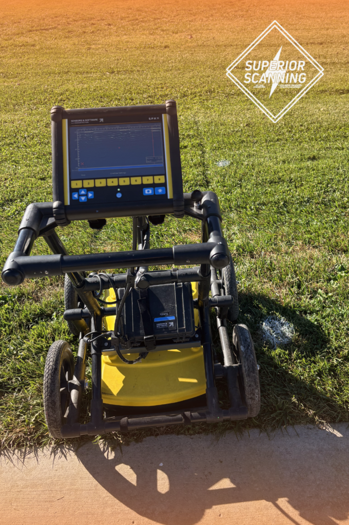
Advanced underground scanning services penetrate soil and concrete to accurately reveal subsurface mysteries. Project engineers rely on a highly specific mix of tools to capture a complete picture of the ground beneath a development lot. Professionals providing GPR scanning services utilize these specific instruments:
- Ground penetrating radar for detecting non-metallic pipes and voids
- Electromagnetic locators for tracing live electrical and communication lines
- Vacuum excavation tools for safe and completely non-destructive visual confirmation
Don’t Cut, Core, or Drill Blind
Superior Scanning is trusted on complex job sites
Who Maps Private Infrastructure?
Specialized private utility-locating companies map out the hidden networks that public systems overlook. Public 811 hotlines only mark city lines up to the meter, which leaves a massive blind spot on commercial lots. A dedicated partner fills this information void safely and effectively.
Dedicated Private Utility Locating Companies
These experts trace the private lines that crisscross large residential properties. They find the unrecorded pipes that government locators are legally prohibited from touching.
Specialized Utility Mapping Services
Professionals turn raw radar scans into highly usable engineering models. The development team uses this data to adjust architectural plans perfectly.
A Certified Utility Locating Company
A reputable firm provides documented proof of the subsurface layout. This certification protects developers from future liability claims and legal disputes.

How Do Scans Protect the Build?
Securing a high-density development requires a methodical approach to subsurface investigation. Integrating expert locators early in the design phase protects existing infrastructure and dictates the exact placement of new structural foundations. Premium underground utility locating services follow a strict workflow:
- Initial site assessment and historical record review
- Comprehensive ground scanning to pinpoint exact pipe locations
- Detailed digital drafting for architectural planning and compliance
Don’t Cut, Core, or Drill Blind
Superior Scanning is trusted on complex job sites
Frequently Asked Questions
What is the difference between public and private utility locators?
Public locators mark government lines up to the meter, while private locators map the unrecorded infrastructure across the entire property.
How deep can ground-penetrating radar see?
The radar typically penetrates three to ten feet, depending entirely on soil composition and moisture levels.
Can a utility locator find PVC or plastic pipes?
Yes, advanced radar equipment detects the density differences between hollow plastic pipes and the surrounding dirt.
When should developers hire a locating company?
Developers must hire locating experts during the early due diligence phase before finalizing any architectural plans.
How much do commercial utility locating services cost?
Pricing depends heavily on the project size and the specific scanning tools required for the job.
How Will You Secure the Next Project?
Mapping out a residential development site before moving a single yard of dirt holds immense value. Precision protects the budget and keeps the construction crew completely safe. Ignoring the subsurface landscape guarantees expensive and dangerous accidents. Contact Superior Scanning to ensure site safety and keep the development completely on schedule.
