
Hitting an undocumented pipe mid-excavation is a nightmare scenario for any project manager. The costs pile up instantly. Successful civil engineering teams know the best way to handle unexpected utility clashes is to catch them before anyone even finalizes the first blueprint.
Superior Scanning serves as a proactive partner in commercial site safety, helping design teams pinpoint hidden underground hazards. Integrating comprehensive subsurface utility engineering right at the start prevents catastrophic accidents and keeps budgets intact. Accurate underground data builds the foundation for a safe, profitable construction project.
Table of Contents
Don’t Cut, Core, or Drill Blind
Superior Scanning is trusted on complex job sites
Why Is Early Integration Crucial for Commercial Site Planning?
Taking a proactive approach during the conceptual phase protects the project timeline and budget in several critical ways. Finding out what lies beneath the dirt early on gives planners options. Proper subsurface utility engineering (SUE) uncovers hidden constraints. This insight gives designers the freedom to route new infrastructure around existing obstacles safely. Securing accurate utility data upfront guarantees a much smoother transition from the drafting table to the active construction site.
Prevention of Expensive Redesigns
Identifying underground clashes early on saves architectural teams from the headache of drafting entirely new foundation plans. Tossing out weeks of hard work hurts the project budget. Civil engineers easily avoid major layout revisions when exact utility corridors are known during the initial design phase. Catching these spatial conflicts early effectively stops a domino effect of delays across all connected construction trades.
Accurate Budget Forecasting
Knowing the exact locations of utilities allows estimators to price out excavation and trenching accurately from day one. Project managers can confidently allocate funds for specific utility relocations without fearing surprise costs down the line. Transparent underground data keeps the entire construction budget stable and predictable.
What Specific ASCE Guidelines Govern the Design Phases?
The American Society of Civil Engineers (ASCE) establishes a progressive framework to classify utility data reliability throughout the drafting process. Understanding these specific benchmarks helps project managers request the exact level of detail required for each planning stage. The industry uses four distinct quality levels to guide safe excavation and design.
Quality Levels D and C for Initial Feasibility
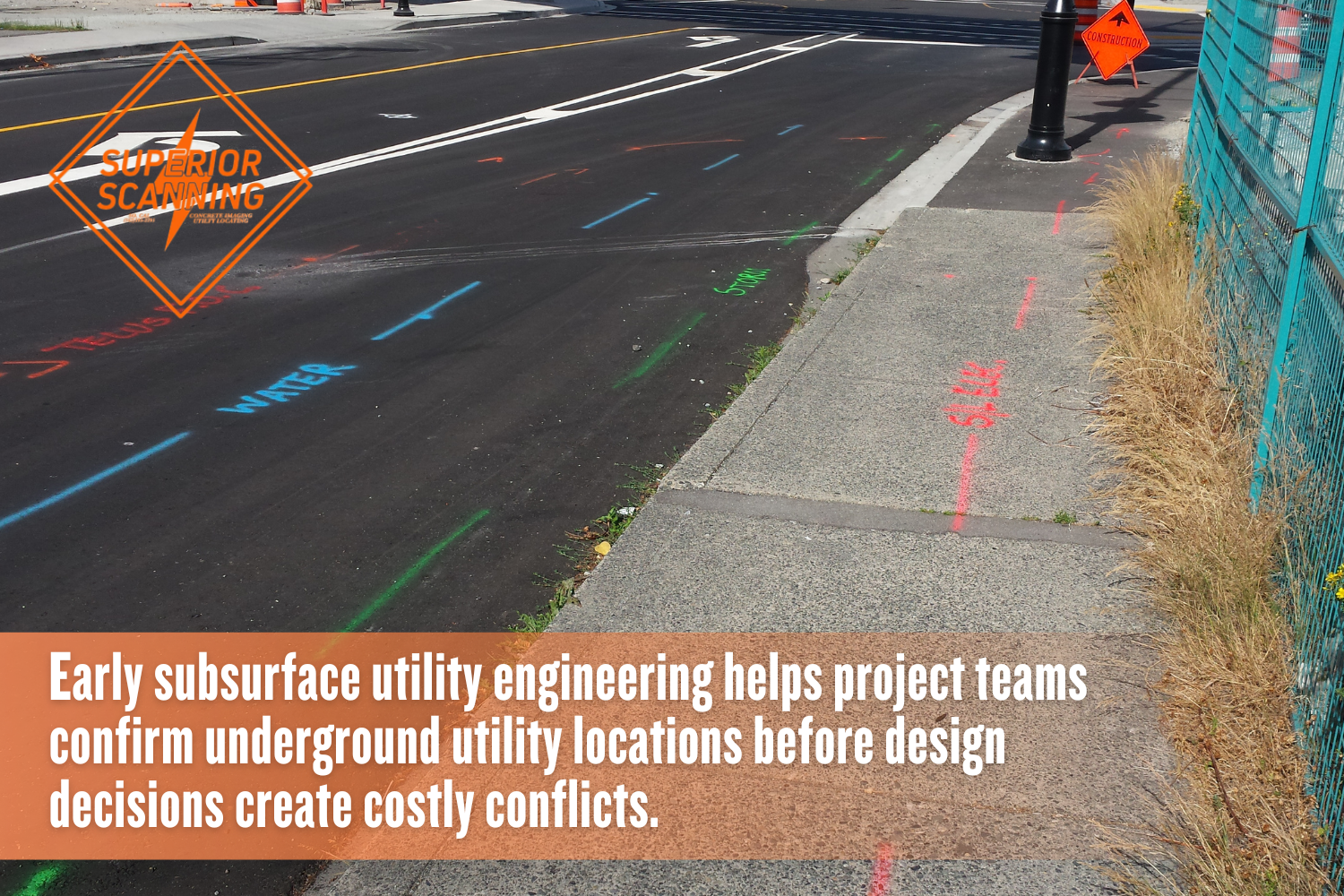
Background research and visual site inspections inform the initial sketches for a commercial property. Utility records and historical maps provide a baseline understanding of existing infrastructure. After gathering this paperwork, surveyors document visible above-ground features, such as manholes and valves to correlate” with “, such as manholes and valves, to correlate them with the recorded utility data.
SUE Level B for Preliminary Mapping
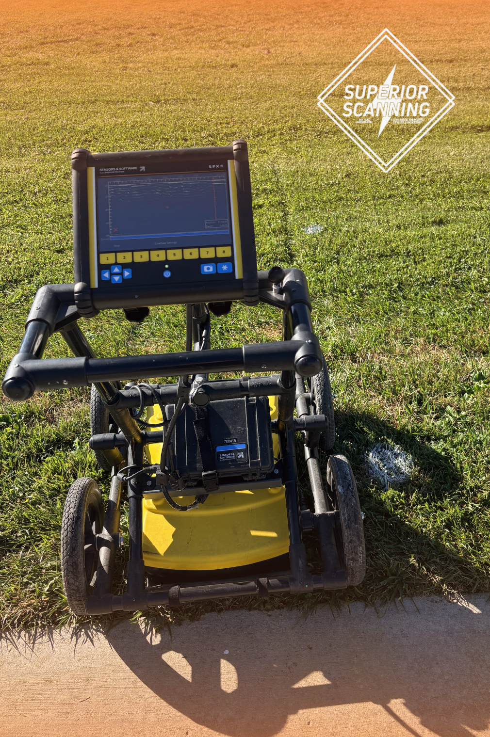
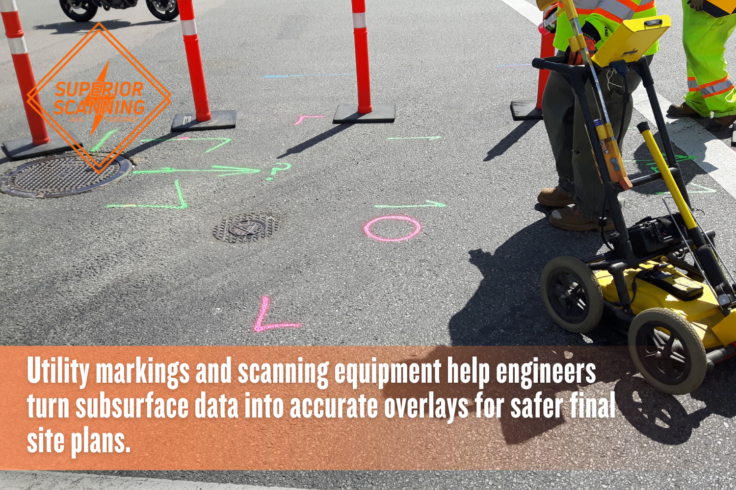
Non-destructive geophysical detection must occur before finalizing the preliminary site layout. Technicians sweep the area using ground-penetrating radar and electromagnetic locators to designate the horizontal position of buried pipes. Locking in reliable SUE Level B data gives designers the confidence to plot safe utility corridors long before breaking ground.
Level A SUE for Final Conflict Resolution
Physical daylighting or potholing is required to finalize exact elevation data before construction bids open. Crews use vacuum excavation to safely expose the utility and measure the precise depth and pipe material. Reaching Level A SUE eliminates all guesswork and delivers the definitive measurements required for complex trenching operations.
Don’t Cut, Core, or Drill Blind
Superior Scanning is trusted on complex job sites
How Do SUE Services Benefit the Final Architectural Plans?
Integrating comprehensive geophysical data transforms the final blueprints and streamlines the approval process, so project managers should book SUE services before finalizing documents to secure the following advantages:
- Creating highly accurate subsurface utility mapping overlays for civil engineering teams.
- Identifying safe, unobstructed corridors for new utility installations.
- Ensuring strict compliance with local municipal excavation codes.
What Happens When Engineers Delay SUE Implementation?
Postponing the engagement of professional subsurface utility engineering companies causes severe logistical nightmares once heavy machinery arrives on site:
- Halting active construction due to unexpected utility strikes.
- Incurring massive change-order fees from excavation contractors.
- Facing prolonged municipal permit approvals due to inaccurate initial site plans.
Don’t Cut, Core, or Drill Blind
Superior Scanning is trusted on complex job sites
Frequently Asked Questions
What Is Subsurface Utility Engineering?
It is the specialized engineering practice of managing the risks associated with underground utilities through comprehensive detection and mapping.
When Should a Project Manager Hire a SUE Company?
The ideal time to hire a detection firm is during the preliminary design or conceptual planning phase to prevent future layout clashes.
What Are the Four Quality Levels of SUE?
The standard ASCE 38-22 guidelines classify utility data reliability into four distinct tiers ranging from Quality Level D to Quality Level A.
Does Subsurface Utility Mapping Guarantee Exact Depths?
Only Quality Level A provides exact depths via physical daylighting and direct measurement of the exposed pipe.
Why Is SUE Important for Highway Construction?
Major roadways conceal a vast amount of legacy infrastructure requiring precise identification before any new grading or paving begins.
Want to Prevent Costly Design Clashes?
Mapping the subsurface before drafting the blueprints yields massive financial and logistical benefits for every commercial construction project. Proactive site investigations protect the ground crew, stabilize the excavation budget, and secure the final construction timeline against unexpected delays.
Superior Scanning serves active commercial, industrial, and government sites across Los Angeles, Orange, Riverside, and San Diego Counties with competitive pricing and rapid deployment. Prevent disastrous utility strikes and expensive layout revisions right now.
Contact Superior Scanning today to schedule immediate subsurface detection and secure complete underground data for upcoming designs.
