 Skip to content
 Trusting a decades-old property blueprint is a massive financial gamble because ground shifts over time and renovations often occur without proper documentation. Making a single wrong cut into an active gas main instantly causes catastrophic project delays and puts the entire crew in physical danger.
Partnering with a trusted expert like Superior Scanning provides the precise utility mapping necessary to keep the site safe. Professional underground utility locating services eliminate the guesswork long before the heavy machinery ever starts digging.
Table of Contents
Don’t Cut, Core, or Drill Blind
Superior Scanning is trusted on complex job sites
What Disrupts Locator Signals?
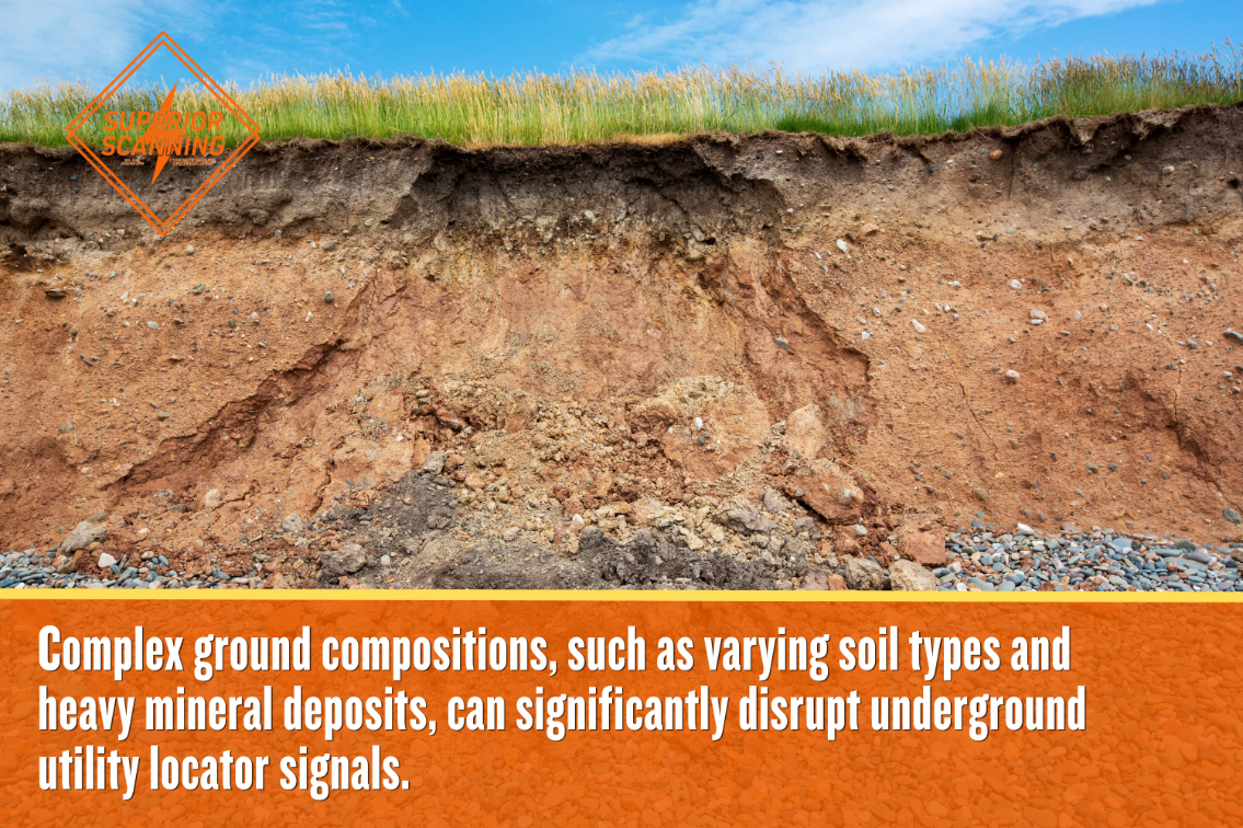
Environmental conditions and ground composition heavily influence the precision of underground utility locating services. Technicians must adjust frequencies to overcome these specific natural obstacles to deliver an accurate map.
High Soil Moisture Content
Water fundamentally changes how radar waves travel through dirt. When rain saturates heavy clay, the wet ground absorbs radar energy rather than bouncing it back to the receiver. This high moisture content drastically limits the equipment’s depth of penetration. The signal simply dissipates into the mud.
Heavy Mineral Deposits
Natural soil composition creates unique challenges. Highly conductive soil packed with iron or salts acts as a mirror for electromagnetic signals. These heavy mineral deposits cause signal scattering, which directly leads to false readings and ghost images for an underground utility locator trying to trace a clear path.
How Does Technology Improve Accuracy?
Utilizing premium tools allows an expert utility locator to provide an exact representation of the subsurface. Combining multiple methods confirms target depths and locations with high confidence.
Ground Penetrating Radar Scans
Modern scanning systems send tiny pulses of energy into the concrete or soil. The machine measures exactly how long those pulses take to bounce back, creating a highly accurate 3D image of the subsurface. It is the only reliable way to identify unmarked voids or buried PVC pipes that traditional metal detectors miss.
Electromagnetic Frequency Tracing
Technicians often need to follow a specific wire through a crowded underground trench. Active tracing involves clamping a transmitter directly onto a known metal pipe or cable. Once the device sends a specific frequency down the line, the operator walks above ground with a receiver tuned specifically to that frequency to map the exact path.
Don’t Cut, Core, or Drill Blind
Superior Scanning is trusted on complex job sites
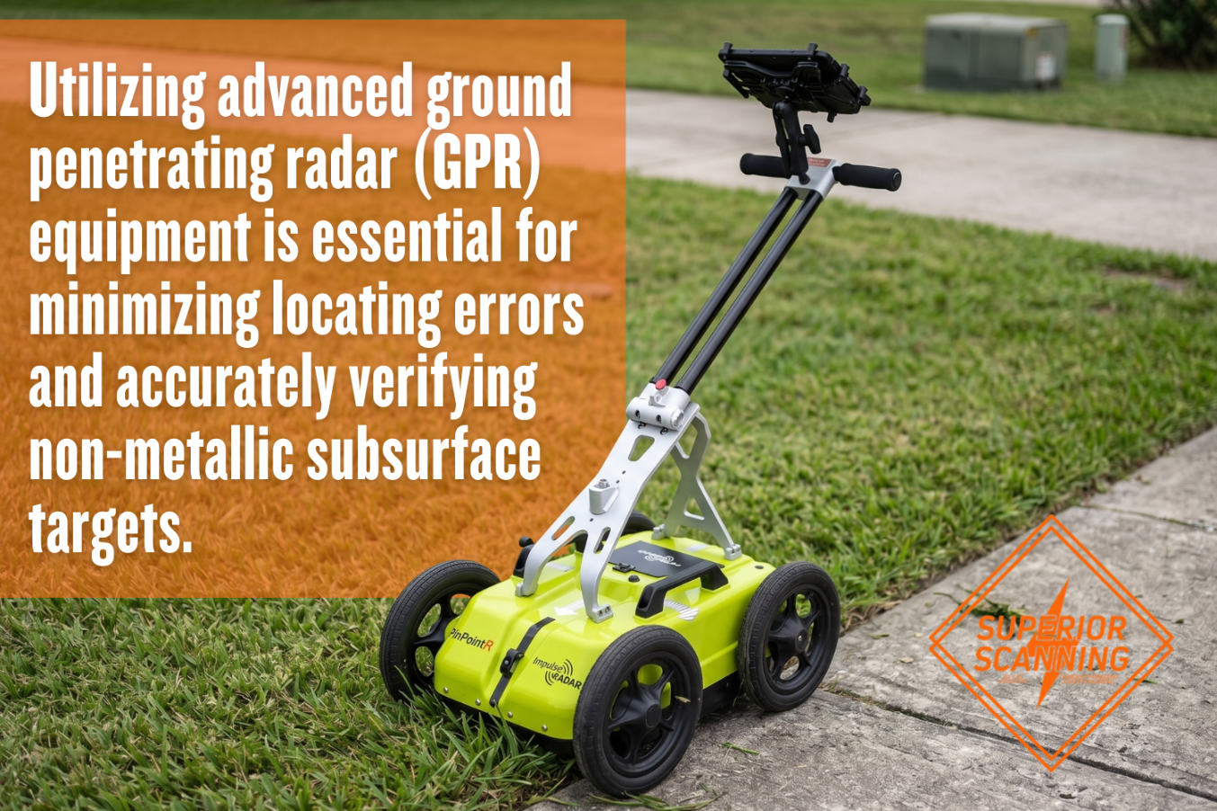
What Equipment Minimizes Locating Errors?
An expert underground utility locator company utilizes advanced underground utility locator equipment to verify subsurface targets, including:
- Ground penetrating radar for non-metallic pipes
- Electromagnetic wands for conductive cables
- Precision line painting for visible surface marking
Why Choose Private Utility Locating?
Construction teams hire private utility locating professionals to mitigate extreme financial and physical hazards, ensuring:
- Absolute protection for on-site crew members
- Strict compliance with municipal excavation laws
- Prevention of costly utility damage fines
Don’t Cut, Core, or Drill Blind
Superior Scanning is trusted on complex job sites
Frequently Asked Questions
How Accurate Is an Underground Utility Locator?
Results are incredibly reliable under normal conditions. However, total accuracy depends heavily on soil density and the specific quality of the underground utility locator equipment the technicians use.
Can Locator Equipment Find PVC Pipes?
Standard electromagnetic wands cannot detect plastic materials at all. Technicians must use Ground Penetrating Radar to effectively locate non-conductive PVC pipes and concrete sewer laterals.
What Do Utility Marking Colors Mean?
The industry follows the standard American Public Works Association (APWA) uniform color code for surface line painting: red marks electrical power lines, yellow indicates highly dangerous gas lines, and blue indicates potable water.
Does Rain Affect Utility Locating Services?
Light drizzles rarely disrupt a scheduled survey. However, standing water and deeply saturated soil severely limit the depth and effectiveness of GPR equipment.
Why Do You Need a Private Utility Locator Company?
Public 811 agencies only mark municipal lines right up to the service meter. Property owners need a private underground utility locator company to safely map the remaining infrastructure across private property.
Want a Flawless Excavation?
Do not leave the safety of a commercial job site up to chance. Keep the project perfectly on schedule by mapping every hidden pipe in advance.
Contact Superior Scanning today for comprehensive underground utility locating services before breaking ground to secure the site with absolute confidence.
