
A single blind dig in a densely packed metropolitan corridor can trigger massive power outages or dangerous gas leaks. Chaotic infrastructure lies just beneath the asphalt of every major city. Relying on outdated maps for excavation guarantees disaster.
Deploying a professional ground-penetrating radar scan (GPRS) service eliminates these hidden risks completely. Project managers use precise GPR for utility location to navigate high-risk environments safely. Superior Scanning serves as the trusted technical partner for site mapping and crew protection.
Table of Contents
Don’t Cut, Core, or Drill Blind
Superior Scanning is trusted on complex job sites
Why Do Urban Environments Require Specialized Subsurface Mapping?
Cities possess decades of unrecorded infrastructure, making public utility maps dangerously inaccurate. A professional GPRS service eliminates the guesswork when navigating complex historical soil layers. Deploying advanced ground-penetrating radar services ensures the project proceeds without encountering hidden hazards.
Mitigation of Cascading Utility Failures
Precise GPRS locating prevents an excavator from severing a primary water main and flooding the surrounding city blocks. Avoiding these major accidents keeps local businesses running and saves the developer from massive liability claims.
Navigation of Complex Historical Soil Layers
Advanced radar penetrates centuries-old foundations and abandoned transit lines built over the original dirt. This deep visibility allows engineers to design safe structural supports without destroying hidden historical artifacts.
Prevention of Catastrophic Project Delays
Mapping the site early prevents unexpected utility strikes that could halt the entire construction schedule for weeks. Keeping the crew moving forward ensures the project finishes on time and stays completely within the budget.

How Do Ground Penetrating Radar Systems Expose Hidden Infrastructure?
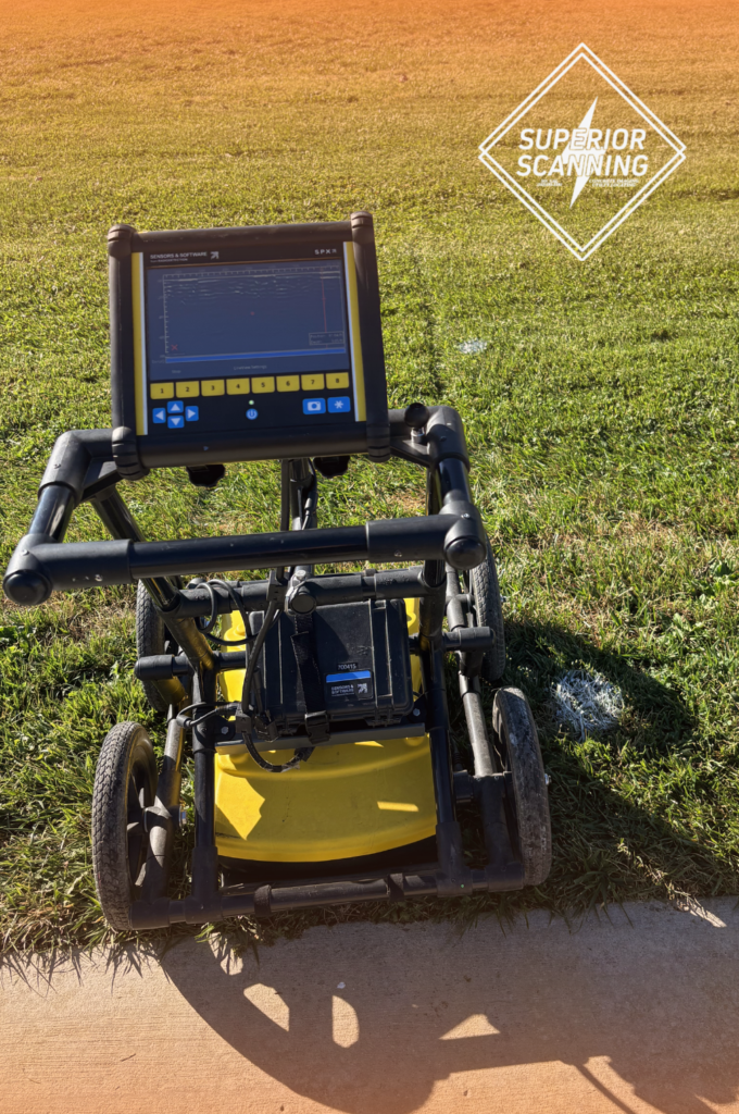
Scanning through asphalt and concrete requires advanced tools to interpret complex soil layers. Modern ground penetrating radar systems translate invisible subsurface anomalies into clear digital maps. Technicians use specific methods to deliver accurate underground scanning services:
- High-frequency radar pulses to detect non-metallic targets like PVC and concrete duct banks
- Electromagnetic induction to trace live electrical and communication lines
- Data aggregation software to filter out dense urban signal interference
Don’t Cut, Core, or Drill Blind
Superior Scanning is trusted on complex job sites
What Advanced Deliverables Are Generated From GPRS Scanning?
Raw radar data becomes highly valuable when converted into formats that structural engineers use daily. Advanced GPRS creates digital assets that empower construction teams to design safe foundations around existing municipal lines. These modern underground scanning services deliver much more than just spray paint on the concrete.
Three-Dimensional Computer-Aided Design Models
Architects import precise spatial data directly into digital design software to plan structural supports accurately. This advanced modeling ensures new building foundations never intersect with existing underground utility lines.
Building Information Modeling Integrations
Engineers integrate subsurface utility locations into master project models to avoid clashes during deep excavations. Sharing this unified digital blueprint keeps the entire construction team aligned and safe from day one.
Comprehensive Subsurface Engineering Reports
Project stakeholders receive detailed documentation proving the site was thoroughly cleared before ground breaking began. These official records satisfy strict municipal permit requirements and protect the development firm from future liability claims.

Who Benefits Most From Comprehensive GPR Utility Mapping?
Key stakeholders rely on precise underground data to execute large-scale urban builds efficiently. Accurate GPR utility mapping ensures high-stakes municipal projects remain safely on track from the initial design phase to final excavation. Professional mapping protects the entire project investment.
Commercial Real Estate Developers
Property buyers evaluate subsurface risks and calculate foundation costs before officially purchasing a downtown lot. This early due diligence prevents them from buying land burdened with incredibly expensive utility relocation fees.
Municipal Infrastructure Planners
City engineers coordinate new transit and utility upgrades without destroying the existing historical infrastructure grids. Accurate scanning ensures these large public works progress smoothly and minimize daily disruptions for local residents.
Telecommunication Network Engineers
Fiber optic installation teams route new high-speed cables safely around heavily congested underground power corridors. Precise mapping stops crews from accidentally slicing through active high-voltage lines while expanding city internet networks.
Don’t Cut, Core, or Drill Blind
Superior Scanning is trusted on complex job sites
Frequently Asked Questions
What exactly is a GPRS service in construction?
This service uses specialized ground-penetrating radar to map buried utilities and hidden structures before excavation begins.
How deep can ground-penetrating radar services see into urban soil?
These machines typically scan up to 10 feet deep, depending on the soil composition and moisture levels.
Why are GPR scanning services better than standard electromagnetic locating?
Radar technology detects non-metallic pipes and concrete vaults that magnetic locators completely miss.
Can an underground scanning service map PVC and plastic pipes?
Yes, the equipment detects the density differences between hollow plastic pipes and the surrounding compacted dirt.
How long does it take to complete a commercial GPR utility mapping project?
A standard commercial site usually takes one to three days to scan and map completely.
Will You Secure the Urban Grid Before Excavation Begins?
Mapping out a downtown development site before moving a single yard of dirt holds immense value. Precision protects the budget, the crew, and the surrounding city infrastructure from catastrophic damage. Taking shortcuts on urban utility mapping guarantees expensive accidents.
Contact Superior Scanning to secure accurate subsurface blueprints and keep the development completely on schedule.
