
A single blind dig hitting an undocumented 19th-century vault instantly halts modern construction. Guessing what lies beneath old urban soils poses an incredibly high risk to budgets and site integrity. A ground-penetrating locator eliminates this dangerous guesswork by providing clear subsurface imaging before excavation begins.
Superior Scanning serves as the trusted technical partner for non-destructive site evaluation. We ensure site safety and keep ground-penetrating radar (GPR) archaeology projects running smoothly.
Table of Contents
Don’t Cut, Core, or Drill Blind
Superior Scanning is trusted on complex job sites
How Does Ground-Penetrating Radar Work on Historic Sites?
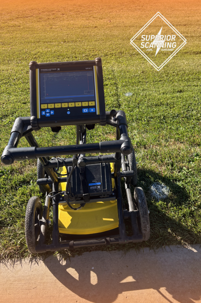
Project managers often ask exactly how ground-penetrating radar works and how it protects fragile subsurface environments. The equipment sends microwave pulses into the soil to detect changes in material conductivity without moving a single shovel of dirt. This advanced georadar technology maps out the invisible past safely while preserving delicate artifacts.
Transmission of High-Frequency Radio Waves
The machine directs specialized radio waves straight into the earth. These pulses travel downward until hitting a buried object or a distinct soil boundary.
Reflection from Subsurface Anomalies
Buried structures cause the radio waves to bounce back to the surface antenna. The system measures the exact time it takes for these signals to return.
Real-Time Data Visualization
The receiver instantly translates the bouncing signals into a visual display. Technicians read this screen to identify historic foundations or forgotten pipes.

What Unrecorded Hazards Does a Geophysical Survey Find?
Older properties consistently hide forgotten structures that standard municipal records missed or lost over the decades. A comprehensive geophysical survey reveals these invisible risks to protect work crews on site. A professional GPR locator detects several specific underground obstacles:
- Abandoned underground storage tanks from past industrial operations
- Forgotten brick vaults, cellars, and masonry foundations
- Unmarked burial sites or historical graves
- Decommissioned clay or cast-iron utility pipes
Don’t Cut, Core, or Drill Blind
Superior Scanning is trusted on complex job sites
Why Is Ground Penetrating Radar Depth Crucial for Older Cities?
Historic infrastructure usually sits much deeper than modern utilities due to centuries of soil grading, construction, and repaving. Determining the correct ground-penetrating radar depth ensures the scan actually reaches the older settlement layers. Technicians adjust the equipment to local geology to penetrate multiple layers of urban fill during a GPR survey.
Adjustment to Soil Conductivity
Dense or wet soils absorb radar signals rapidly, limiting visibility. Operators must calibrate the system to safely push through these conductive materials.
Selection of Proper Antenna Frequencies
Low-frequency antennas send signals deep into the earth to find older historical layers. High-frequency antennas provide sharper images of objects buried closer to the surface.
Penetration through Asphalt and Concrete Layers
Modern cities often pave over historical sites multiple times. The radar must penetrate these thick caps to reveal the older structures beneath.

How Do Modern Scanners Improve GPR Utility Mapping?
Modern locating goes far beyond simply marking the ground with paint or colored flags. Today, technicians use advanced software to translate raw radar signals into actionable digital blueprints for architects and construction crews. Effective GPR utility mapping delivers the following valuable assets:
- Integration of subsurface data into computer-aided design software
- Creation of three-dimensional building information models
- Delivery of comprehensive structural and utility reports
Don’t Cut, Core, or Drill Blind
Superior Scanning is trusted on complex job sites
Frequently Asked Questions
What materials can a ground-penetrating locator detect?
A ground-penetrating locator detects metallic pipes, plastic conduits, concrete vaults, and disturbed soil boundaries.
How deep can a GPR survey see underground?
A standard GPR survey reaches between three and ten feet deep, depending on the specific soil composition and moisture content.
Is ground penetrating radar safe for historic preservation?
Yes, ground-penetrating radar is completely non-destructive and causes no harm to buried historical artifacts.
Can a geophysical survey find plastic or PVC pipes?
Yes, the equipment spots the density difference between a plastic pipe and the surrounding dirt.
How accurate is georadar in wet or clay-heavy soils?
High moisture and clay content absorb radio waves, reducing the maximum depth the georadar can accurately scan.
Will You Uncover the Past Before Breaking Ground?
Non-destructive testing is absolutely essential for historic and unrecorded sites before heavy machinery arrives. Proactive scanning prevents structural damage, protects cultural heritage, and avoids costly project delays. Hitting an unrecorded vault ruins budgets and halts construction indefinitely.
Contact Superior Scanning to secure an accurate subsurface map and protect the site before starting any excavation.
