
One wrong scoop of dirt can bring a massive commercial construction project to a dead stop, creating immense stress for project managers. You are expected to keep schedules tight and crews safe every single day, making you an absolutely non-negotiable professional underground utility locator. Knowing exactly what sits beneath the soil prevents costly delays and severe injuries while keeping the project moving forward.
Superior Scanning helps crews prep sites safely and accurately. Reach out to the team early to secure a solid foundation for your next project, but make sure to ask the right technical questions first to guarantee comprehensive site safety.
Table of Contents
Don’t Cut, Core, or Drill Blind
Superior Scanning is trusted on complex job sites
1. What Specific Technologies Do You Deploy On-Site?
You cannot trust a complex commercial site to just one piece of equipment. Relying on a single tool almost always leaves dangerous blind spots. That is why finding a versatile utility line locator is critical for capturing the full subsurface picture before excavation begins.
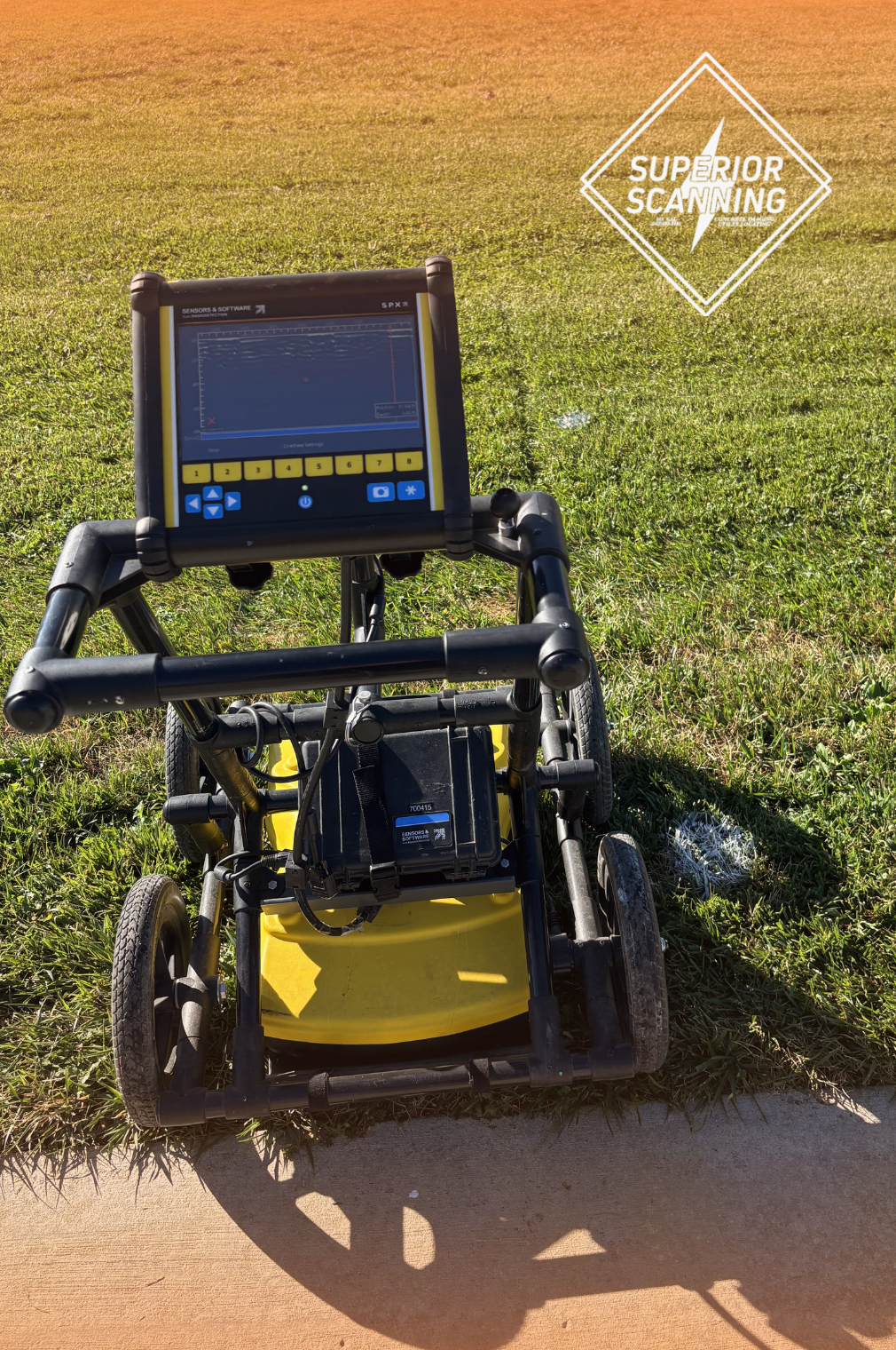
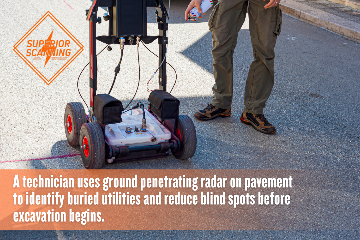
Ground Penetrating Radar and Electromagnetic Induction
Field technicians usually start with ground-penetrating Radar (GPR) to locate structural anomalies and buried voids. But radar alone is not enough. They pair it with electromagnetic induction. This specific combination allows the team to safely trace live power lines and conductive metal pipes.
Specialized Cable Locator Systems
Hitting a fiber optic network is a fast way to anger an entire neighborhood and rack up massive repair bills. Standard gear often struggles to track these sensitive lines. A specialized cable locator accurately locates communication cables so your digging crew can work around them without issue.
2. Can Your Equipment Detect Non-Metallic Hazards?
Basic metal detectors miss a massive portion of modern infrastructure. You need an advanced underground pipe locator to detect materials such as plastic and concrete. The right technology exposes these hidden dangers long before your heavy machinery arrives on the property.
High-Frequency Radar Systems
Standard tools ignore Polyvinyl Chloride (PVC) entirely. High-frequency radar solves this problem by sending waves deep into the soil. These waves bounce off sudden changes in material density. This reaction reveals exactly where hidden plastic and concrete pipes sit.
Acoustic and Sonar Detection Methods
Some older municipal water systems rely on deep lines made from non-conductive materials. Radar sometimes struggles at those extreme depths. Technicians use acoustic and sonar tools to send sound waves directly through the pipes to trace the water line safely and accurately.
Don’t Cut, Core, or Drill Blind
Superior Scanning is trusted on complex job sites
3. How Do You Handle Highly Congested Subsurface Areas?
Urban environments are a mess of overlapping infrastructure. Isolating a single target line through heavy signal interference takes serious expertise. Professionals use specific filtering strategies to make sense of the noise:
- Cross-referencing historical as-built plans with real-time physical scans.
- Adjusting radar frequencies to filter out shallow debris and target deeper anomalies.
- Utilizing advanced utility mapping software to create clear visual separation between overlapping utility lines, which is exactly how the Superior Scanning team untangles complicated grids.
4. Do You Provide Permanent Digital Deliverables?
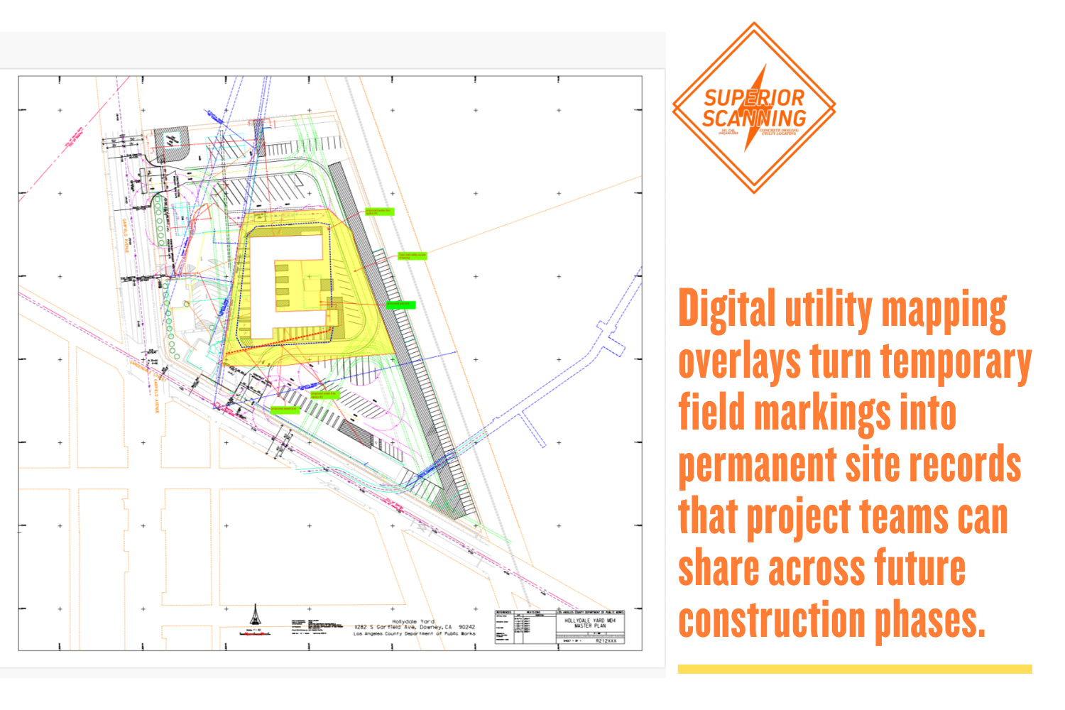
Spray paint on dirt washes away in the rain or vanishes under tire tracks. You want a private utility locator who delivers lasting digital blueprints. These files protect your site during future phases long after the physical marks fade.
Comprehensive AutoCAD Overlays
Experts take the physical field marks and translate them into layered digital blueprints. These comprehensive AutoCAD overlays give your engineering team a permanent record of every identified hazard. You can instantly share this exact subsurface data across different construction departments.
GPS-Integrated Site Mapping
Blueprints need real-world context to be genuinely useful. GPS-integrated tools log the exact geographic coordinates of every pipe and cable. Tying the hazards to specific longitudes and latitudes guarantees future digging crews know exactly where to maneuver.
5. How Do You Integrate With Local Municipal Guidelines?
A safe job site bridges the gap between public streets and private property. The transition requires a clear, defined workflow:
- Reviewing the initial call before you dig public markings to establish baseline infrastructure.
- Applying standard American Public Works Association (APWA) color codes universally across the job site for immediate visual recognition.
- Securing the perimeter immediately beyond the municipal meter where public jurisdiction ends.
Don’t Cut, Core, or Drill Blind
Superior Scanning is trusted on complex job sites
Frequently Asked Questions
What Does an Underground Utility Locator Do?
An underground utility locator actively detects, traces, and maps buried infrastructure to keep construction sites safe.
Is a Private Utility Locator Different From 811?
A private utility locator scans the entire property for hazards, whereas 811 only marks public lines up to the municipal meter.
How Much Does an Underground Utility Locator Cost?
Pricing depends heavily on your specific site size, soil complexity, and the required digital deliverables.
Can an Underground Utility Locator Find PVC Pipes?
Ground penetrating radar successfully identifies plastic and non-metallic pipes based on sudden shifts in soil density.
How Accurate Is Utility Line Locating?
Modern locating tools are incredibly precise and typically accurate within a few inches under ideal soil conditions.
Who Secures the Job Site?
Hiring an under-equipped technician exposes your commercial build to massive financial liabilities. One undocumented pipe break can ruin a strict project timeline. Project managers must verify the exact capabilities of scanning partners to prevent utility strikes before they occur.
At Superior Scanning, the team serves active construction and facility sites across Southern California. Primary service areas include Los Angeles County, Orange County, Riverside County, and San Diego County. Request a quote now and lock in professional scanning before the first shovel hits the ground.
