 Skip to content
 Handing a crew a set of thirty-year-old property blueprints and telling the operator to dig often leads to immediate danger. One wrong cut into a high-pressure gas line or fiber optic cable shuts down a site instantly, putting the construction team at physical risk and tanking the project budget.
Bringing in a skilled underground utility locator removes that dangerous guesswork completely. Partnering with a trusted expert like Superior Scanning provides the exact subsurface mapping needed to keep everyone safe, preventing costly accidents and keeping the work moving exactly as planned.
Table of Contents
Don’t Cut, Core, or Drill Blind
Superior Scanning is trusted on complex job sites
What Disrupts Locator Signals?
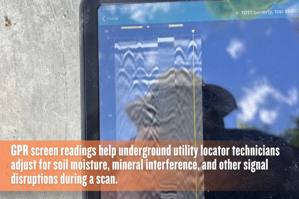
The dirt under your boots is rarely just plain dirt. Environmental conditions and shifting ground composition heavily influence the precision of underground utility locating services. A good technician constantly adjusts equipment frequencies to punch through these specific natural roadblocks and deliver an accurate map. Understanding what messes with a signal is the first crucial step in keeping an excavation safe.
High Soil Moisture Content
Think about trying to shine a flashlight through thick fog. Saturated, wet clay does something very similar underground. It absorbs radar waves and strictly limits the gear’s depth penetration. Ground Penetrating Radar struggles to propagate a clean signal through heavy moisture, requiring operators to quickly adapt the scanning approach to obtain a clear picture.
Heavy Mineral Deposits
Highly conductive soils, such as those loaded with iron or salt, cause significant signal scattering. This often creates frustrating false readings for an underground utility locator. Those rich mineral deposits bounce the tracking frequencies in a dozen different directions. Operators rely on specialized training to filter out the static noise and find the actual buried targets.
What Equipment Minimizes Locating Errors?
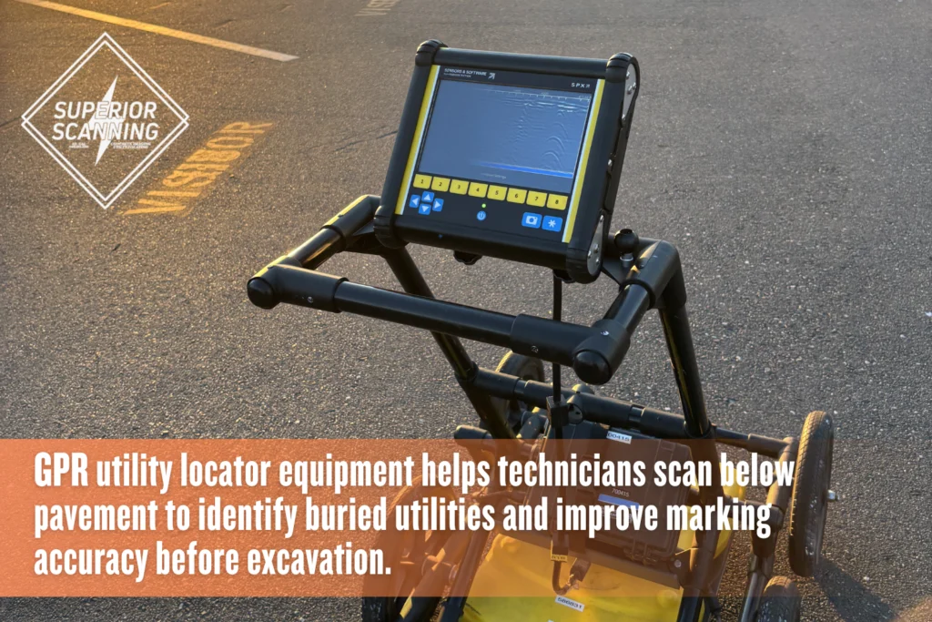
To thoroughly verify subsurface targets, an expert underground utility locator company utilizes advanced underground utility locator equipment, including:
- Ground penetrating radar for non-metallic pipes
- Electromagnetic wands for conductive cables
- Precision line painting for visible surface marking
Don’t Cut, Core, or Drill Blind
Superior Scanning is trusted on complex job sites
How Does Technology Improve Accuracy?
Guessing is simply not an option in modern construction because precision prevents accidents. Utilizing premium tools enables an expert utility locator to provide an exact representation of what lies below grade. Mixing and matching multiple methods confirms target depths and locations with absolute certainty. This layered technological approach ensures no hidden cable goes unnoticed before the heavy machinery rolls in.
Ground Penetrating Radar Scans
Radar gives the crew a full picture of the unseen hazards. GPR creates an accurate 3D image of the earth below to identify unmarked voids or buried PVC pipes. This specific scan reveals the non-metallic materials that older, traditional locating tools completely miss.
Electromagnetic Frequency Tracing
Active tracing involves sending a very specific frequency down a known utility line to map the exact path. A technician walks above with a surface receiver to pick up that targeted signal. This lets the operator mark the precise, winding route of a conductive cable right on the pavement or grass.
Why Choose Private Utility Locating?
Construction teams hire private utility locating professionals to mitigate extreme financial and physical hazards, ensuring:
- Absolute protection for on-site crew members
- Strict compliance with municipal excavation laws
- Prevention of costly utility damage fines
Don’t Cut, Core, or Drill Blind
Superior Scanning is trusted on complex job sites
Frequently Asked Questions
How accurate is an underground utility locator?
While highly reliable on most sites, accuracy ultimately depends on soil conditions and the quality of the underground utility locator equipment used.
Can locator equipment find PVC pipes?
Standard electromagnetic tools cannot find plastic, but GPR effectively locates these non-conductive materials.
What do utility marking colors mean?
The American Public Works Association (APWA) uniform color code used in line-painting designates specific hazards, such as yellow for gas and red for live electric wires.
Does rain affect utility locating services?
Light rain is perfectly manageable, but standing water or deeply saturated mud limits the overall effectiveness of GPR equipment.
Why do you need a private utility locator company?
Public 811 services only mark municipal lines up to the street meter, requiring a private underground utility locator company to map the rest of the property safely.
Want a Flawless Excavation?
Smart site managers refuse to dig blindly. You need to secure comprehensive underground utility locating services from Superior Scanning before that first excavator arrives. Bringing in a private utility-locating team to map out the hazards eliminates the guesswork that can ruin budgets and timelines.
Schedule a thorough site inspection today to keep the upcoming excavation completely safe and on track.
